
We continue with the cold theme for many areas over the next 48 hours or so. The wintry weather will become increasingly confined to northern hills through Saturday night and into Sunday. We stay with the cool east to northeasterly flow which will bring further snow showers, even into Monday across the higher ground in the north, however to lower ground precipitation will be falling as rain, hail and at times sleet.
The showers will be heaviest and most frequent across eastern coastal counties of England and Scotland (north sea facing coasts) and we maintain the risk of one or two of these showers being thundery in nature. Whilst many central and western areas remain cold and dry, however due to the easterly element in the flow we may see some showers penetrating further inland to affect some central and central southern areas at times.

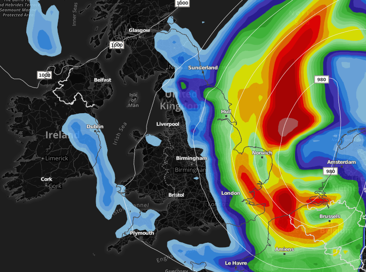
Late Monday and into Tuesday we see the risk of some heavy rain and stronger winds developing from the southeast. Latest model output shows an area of low pressure moving up from the near continent to affect parts of Yorkshire, Lincolnshire, East Anglia and southeast England. Whilst there is some uncertainty with regards to the track of this area of low pressure at the moment it is looking increasingly likely that these areas will see some longer spells of rain and fresher winds. As shown on the images below.

