
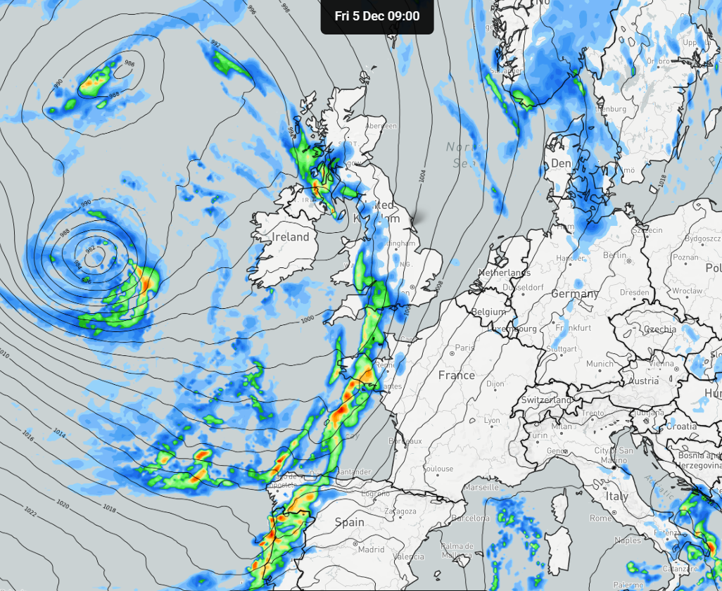
Meteorological winter will get off to a wet and unsettled start with low pressure dominating the United Kingdom!
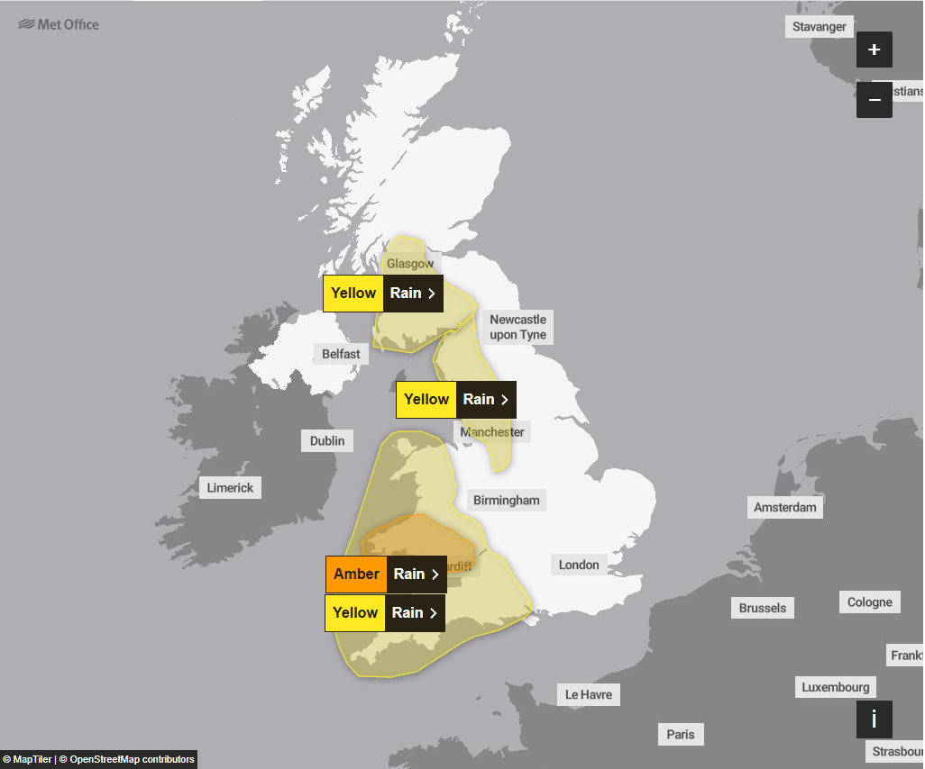
There are currently numerous weather warnings in place for heavy and prolonged rainfall affecting western and northwestern parts of the UK. It will be parts of Wales and North-West England which sees the main bulk of wet weather over the coming 48 hours or so.
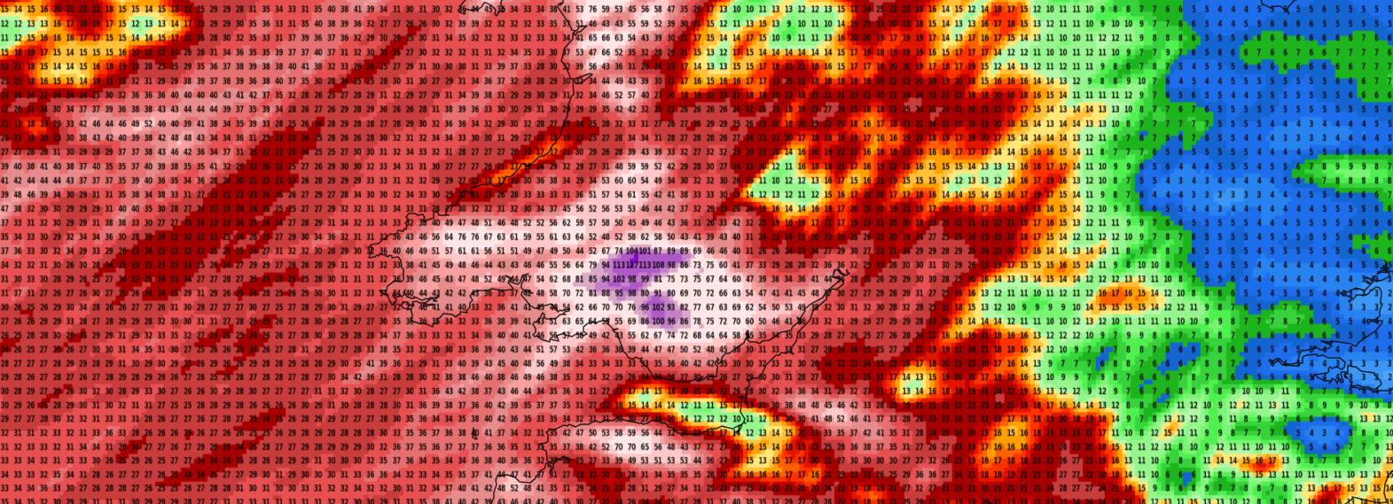
Some parts of Wales, particularly over higher ground, may see in excess of 120mm, which is certainly a fair amount of rainfall in such a period of time. The warnings in force cover tomorrow and Tuesday, with an amber warning covering parts of Wales.
It is also worth noting that parts of Cumbria may also see rainfall totals in excess of 100mm over a 48 hour period. Flooding is certainly a concern for some areas!
Looking ahead and low pressure will dominate our weather over the coming weeks. The models are starting to hint at something potentially colder developing further down the line, however, we’ve some very unsettled conditions to get through first!
Make sure you keep up to date via our social media channels. You can follow our main Facebook page by clicking here.