
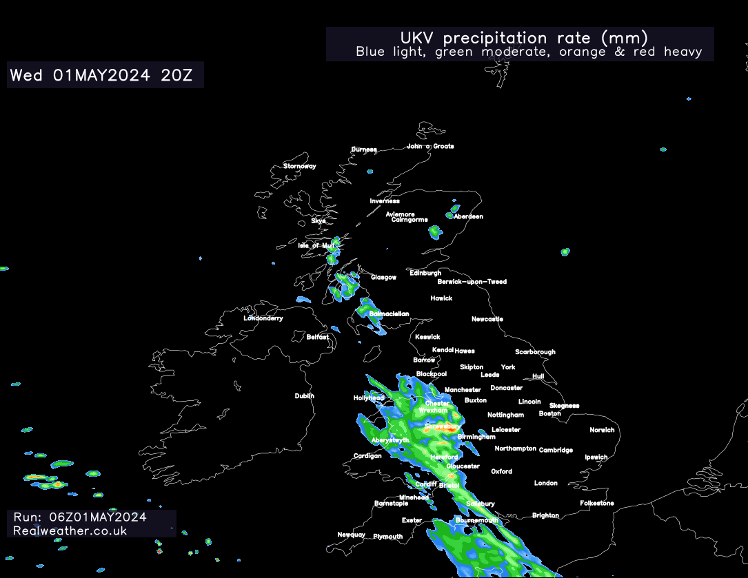
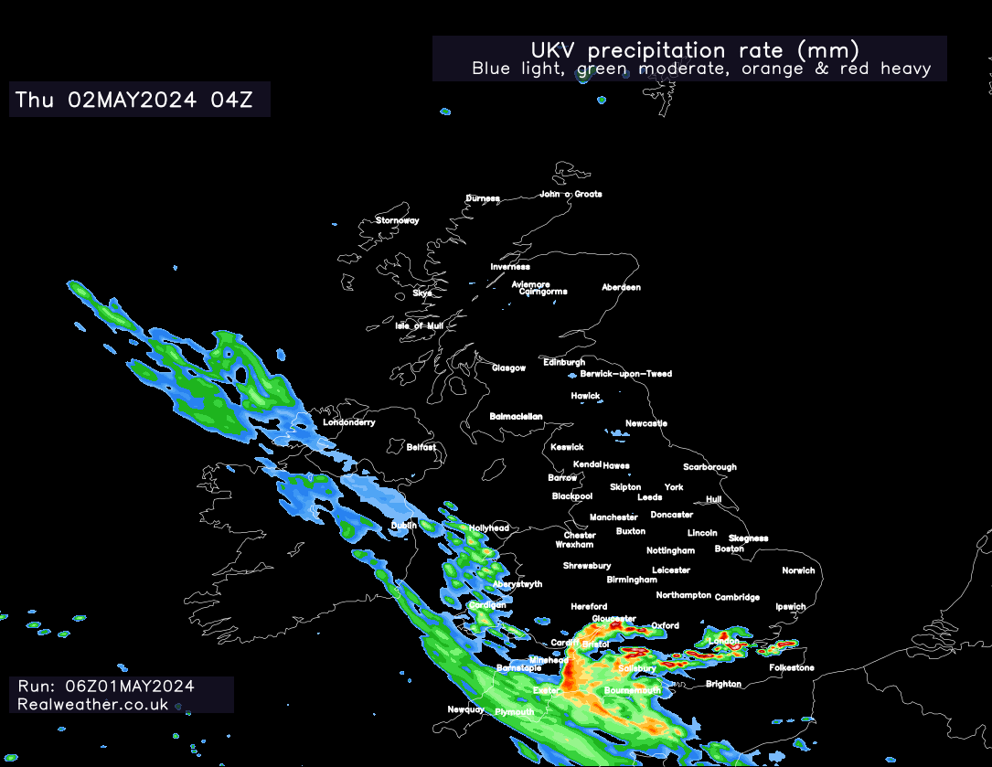
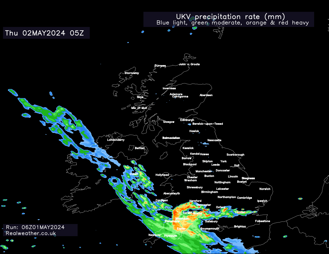
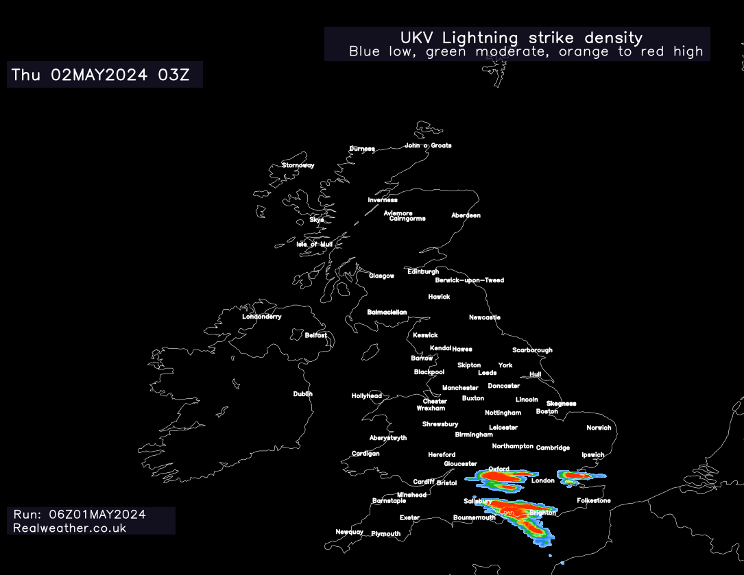
Wet weather slowly moves up from the near continent (France) through the day and into this evening. During the early hours of tomorrow morning we’ll see some rather extensive & heavier rainfall developing across much of the south, south-west and then extending into Wales.
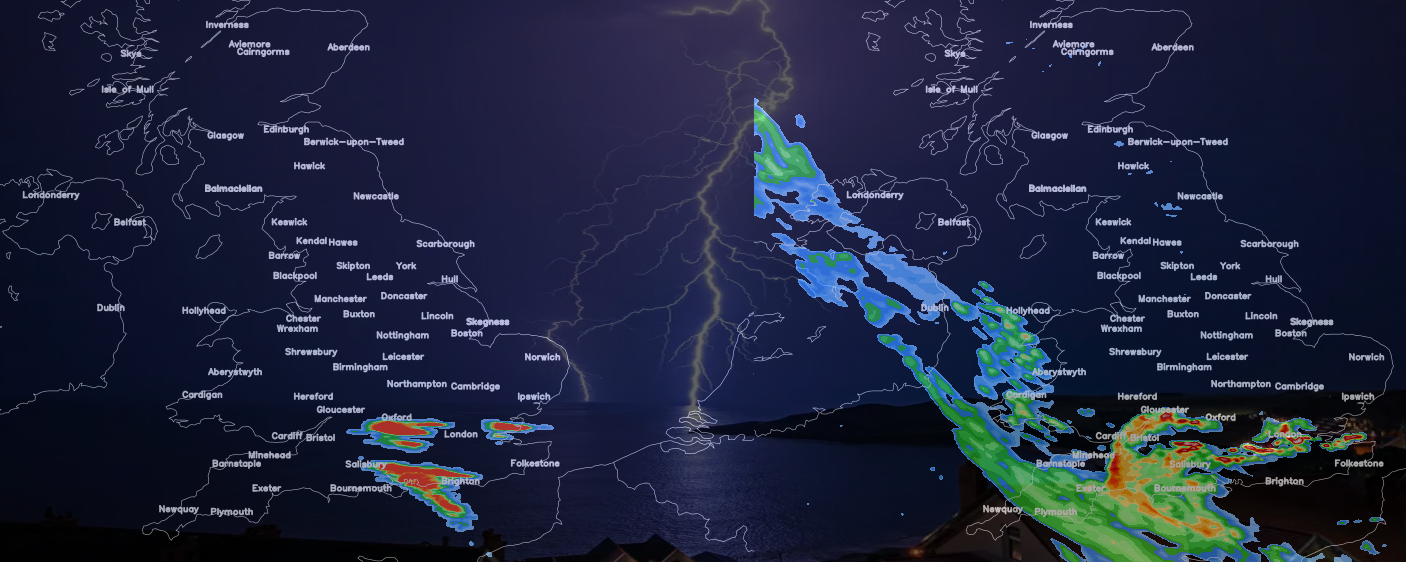
We will also see the risk of some lively thunderstorms developing in places!
As I’ve been highlighting in the Pro Facebook group over the last week, we do have a convective risk overnight and through the early hours of tomorrow morning.
The models are hinting at some torrential downpours developing across parts of south-east England, southern England and central southern parts of England during the early hours of tomorrow morning. There is the potential for some rather lively thunderstorms.
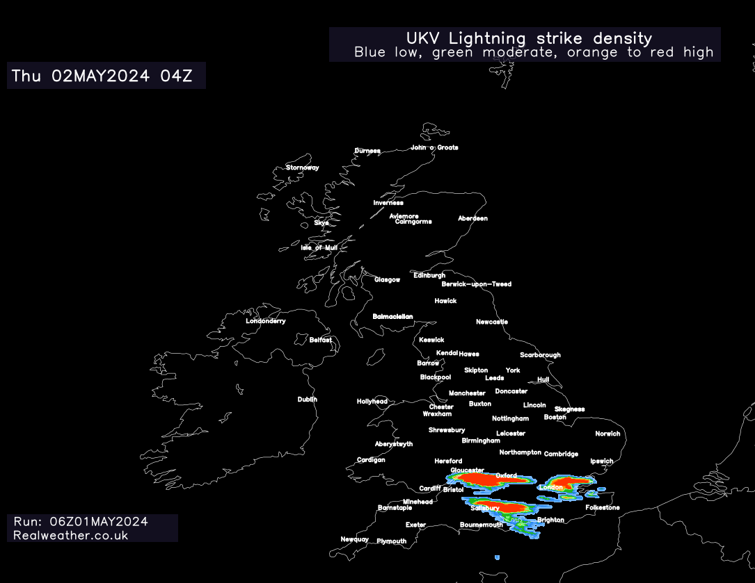
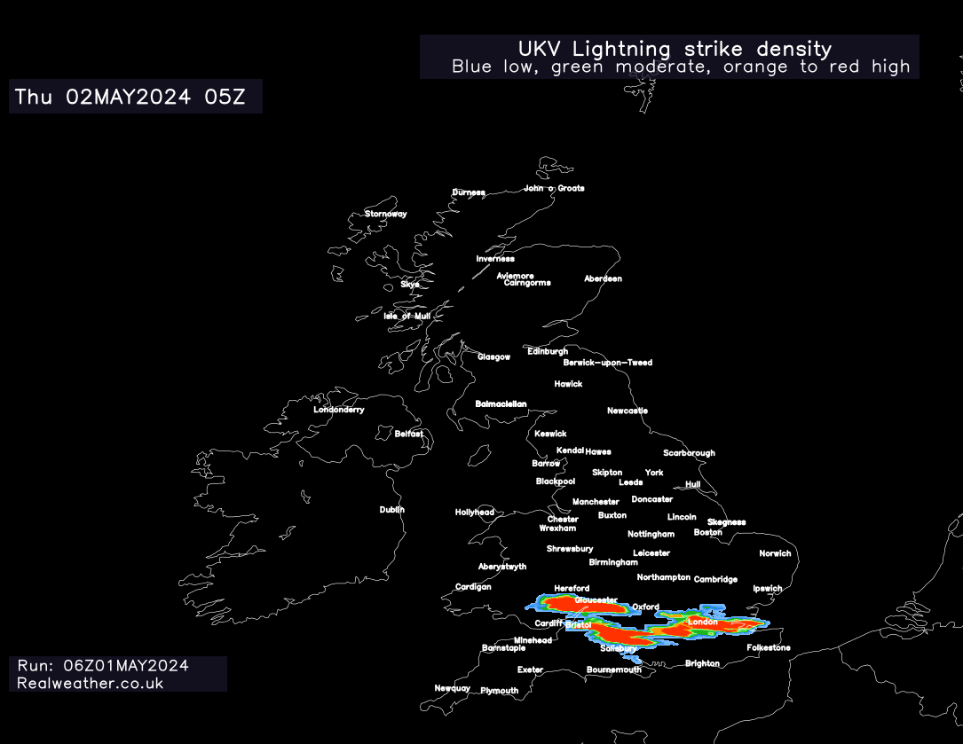
The risk then perhaps extending into parts of Wales later tomorrow morning.
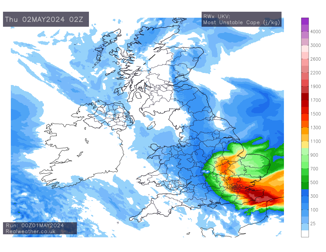
Looking at the energy values (CAPE) there are certainly high values supporting development of severe storms, particularly across parts of south & south-east England, if we see development come to fruition.
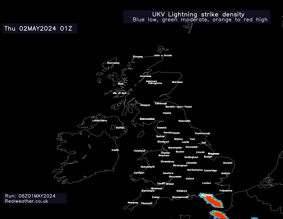
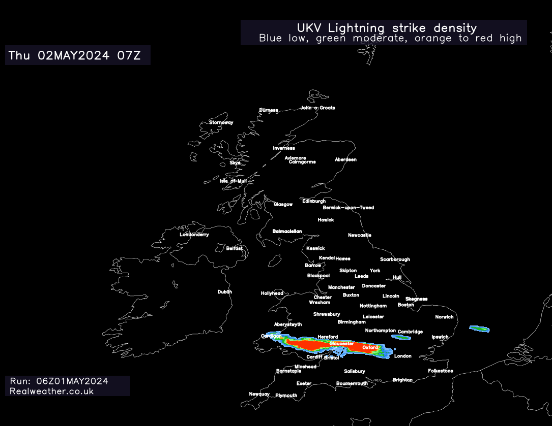
Risks are large hail, localised flash flooding and frequent lightning. Showcasing the new charts I’ve been working on, please find attached to this post lightning strike density from the UKV high resolution model.
If you’re in the south, eyes to the radars and sky tonight, it could be rather lively! Don’t forget to grab our new Pro mobile app to track the overnight storms and stay one step ahead with future weather! Click here for more information.
All charts and chart styles on this page are copyright 2024 RWX LTD.