
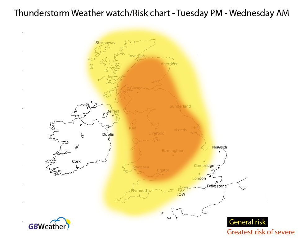
There is a risk of severe thunderstorms affecting parts of Wales, central England, northern and northwestern parts of England, Yorkshire, Lincolnshire and Scotland late tonight and into the early hours of Wednesday morning.
Whilst other areas (highlighted on the below map) are at risk of seeing some locally heavy thunderstorms the main emphasis is central and northern areas (marked in orange on the map).
Areas of thunderstorms are expected to develop across parts of Wales and the W Midlands tonight and these will then track northeastwards late tonight and into the early hours of Wednesday morning. They’re expected to intensify as they track northeastwards.
Frequent lightning, hail, gusty winds and heavy downpours are to be expected. The warning was issued at 8:50am this morning. I will be covering the thunderstorms live inside the premium Facebook group tonight. If you would like to join you can find information below the warning map underneath this text.

GB Weather prides its self in providing the best weather data in the United Kingdom ranging from our high resolution models, thunderstorm forecast systems, regional high resolution charts, snow and gritting systems in the winter and accurate weather forecasts. You can access all of our website and features and gain access to our premium weather group on Facebook where Lewis provides daily forecasts, video forecasts, live video forecasting, questions and answers session, long range forecasts, severe weather updates, snow forecasts and much more. Over 1,200 people and growing use our new pro services, you can find the link to the pro Facebook group inside the ‘My account’ section on the navigation. Register today, you won’t look back!
Pro Monthly
£3.00 per Month.

Pro Yearly
£32.99