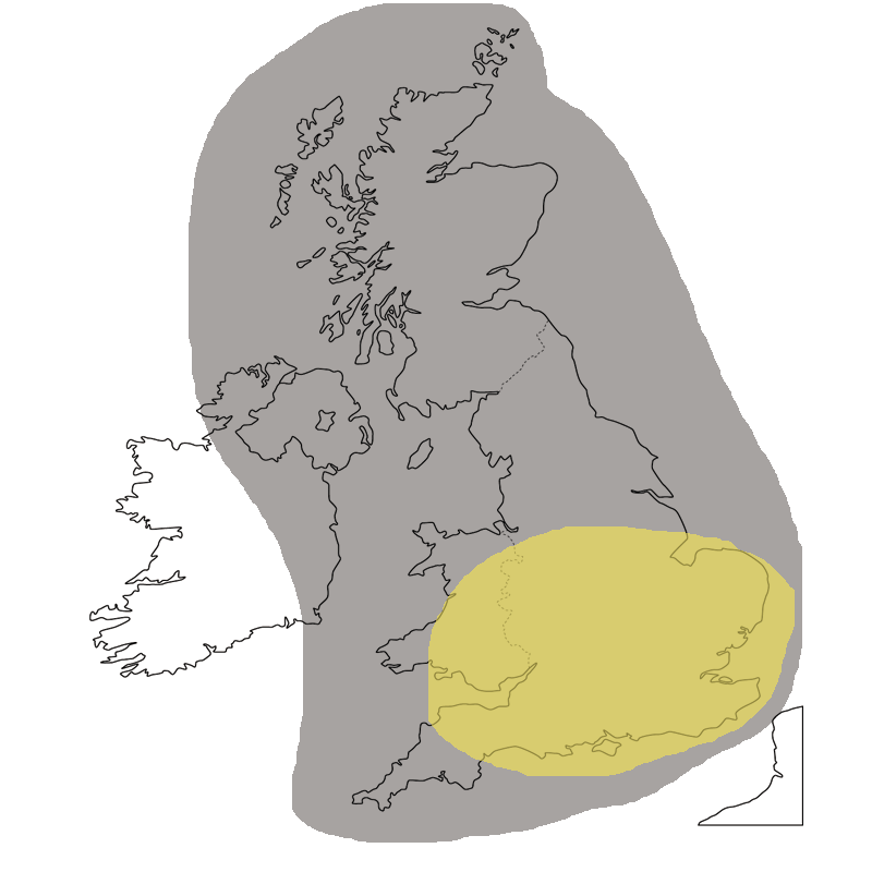
Thunderstorm risk – Thursday 13th August 2020

There is a risk of heavy thunderstorms across parts of England and Wales today. The thunderstorms will become organised at times with torrential downpours leading to flash flooding, frequent lightning and large hail.

You can find the risk map below.

If you require more extensive forecasts and services you can upgrade to our Pro service which includes access to our behind closed doors Facebook group. Click here for more information. 

Forecaster: Lewis 


⛈️ ⚡️ Want access to extra data, extensive forecasts to your newsfeed + more? ❄️ 💨


Gain access to our Pro group on Facebook, packed full of daily weather information, medium range, long range and bespoke forecasts. As part of a Pro member you also gain access to all of our website data and premium charts, including regional versions of weather models and our new interactive Pro maps viewer, all advert free. If that's not enough, you will also have access to our Pro Android app and IOS WEB APP.

👉 Click here to sign up today!

Weather tools

will it be hot?


Forecast Models

UKV Weather Model

RWx pro model


ECM Weather Model

Arpege model