
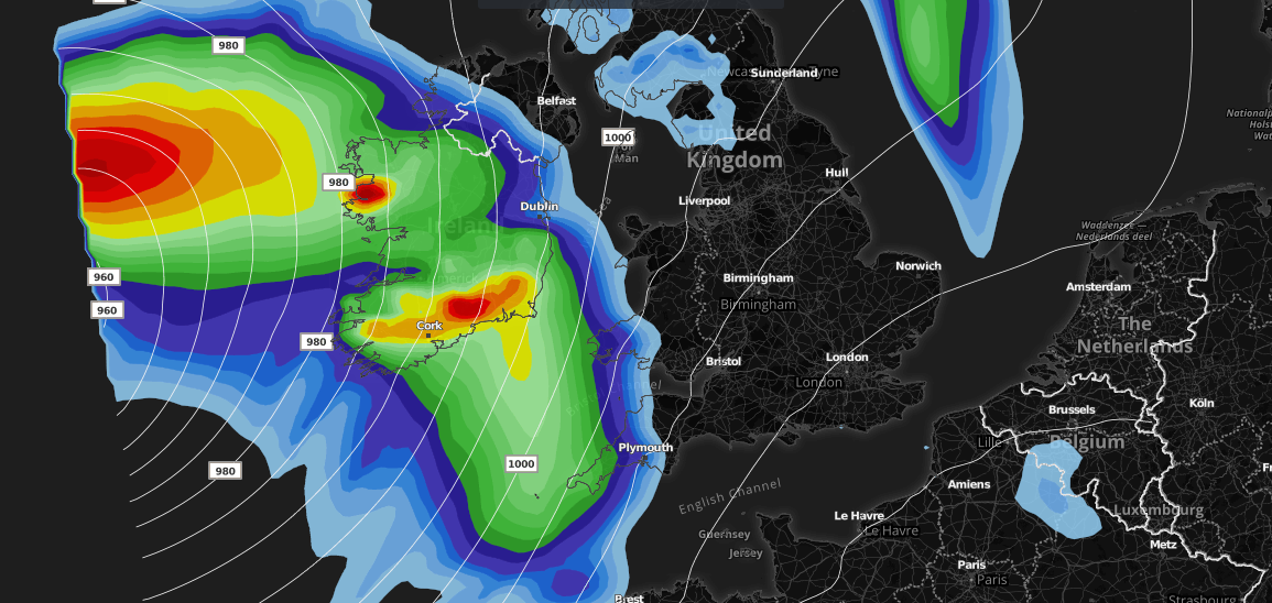
An area of low pressure is expected to track close to the United Kingdom late Thursday and will head NNE during Friday morning. Whilst strong winds are associated with this area of low pressure, thankfully many areas will escape the strong winds, however many areas will be blustery during Friday.
The low tracks NNE late Thursday night bringing severe gale force winds across much of Ireland and Northern Ireland, especially west and southwest coasts. Strong winds (gale force) will also affect the southwest of England and Irish sea coasts in general. Through Friday the strongest winds then extend northwards into parts of W, SW and NW Scotland including the Western Isles of Scotland. The image below shows expected wind gusts from this system at different timeframes.
Wind gusts – 07:00 Friday.

Wind gusts – 10:00 Friday.

Wind gusts – 16:00 Friday.

The system will also bring spells of heavy rain across Ireland, Northern Ireland, Scotland the far north of England and parts of the southwest and Wales. Although at the moment many eastern, central, southern and southeastern areas are expected to stay relatively dry throughout the period. As shown on the accumulated precipitation (total rainfall amounts in mm) chart below. It is worth noting that day time temperatures will be well above average for the time of year with temperatures perhaps pushing the low to mid-twenties.
Accumulated precipitation (Tuesday 12:00-Saturday 12:00)

There may be some changes in the track and depth of this area of low pressure so with that in mind please keep up to date with our forecasts via our Facebook page and website. Charts used are from our ProExtra membership, click here for more information.
Forecaster: Lewis Dobson