

We’ve certainly seen a wet start to Spring with low pressure mostly dominating our weather. No surprise that the remainder of this week and more especially into the weekend period brings yet more rain!
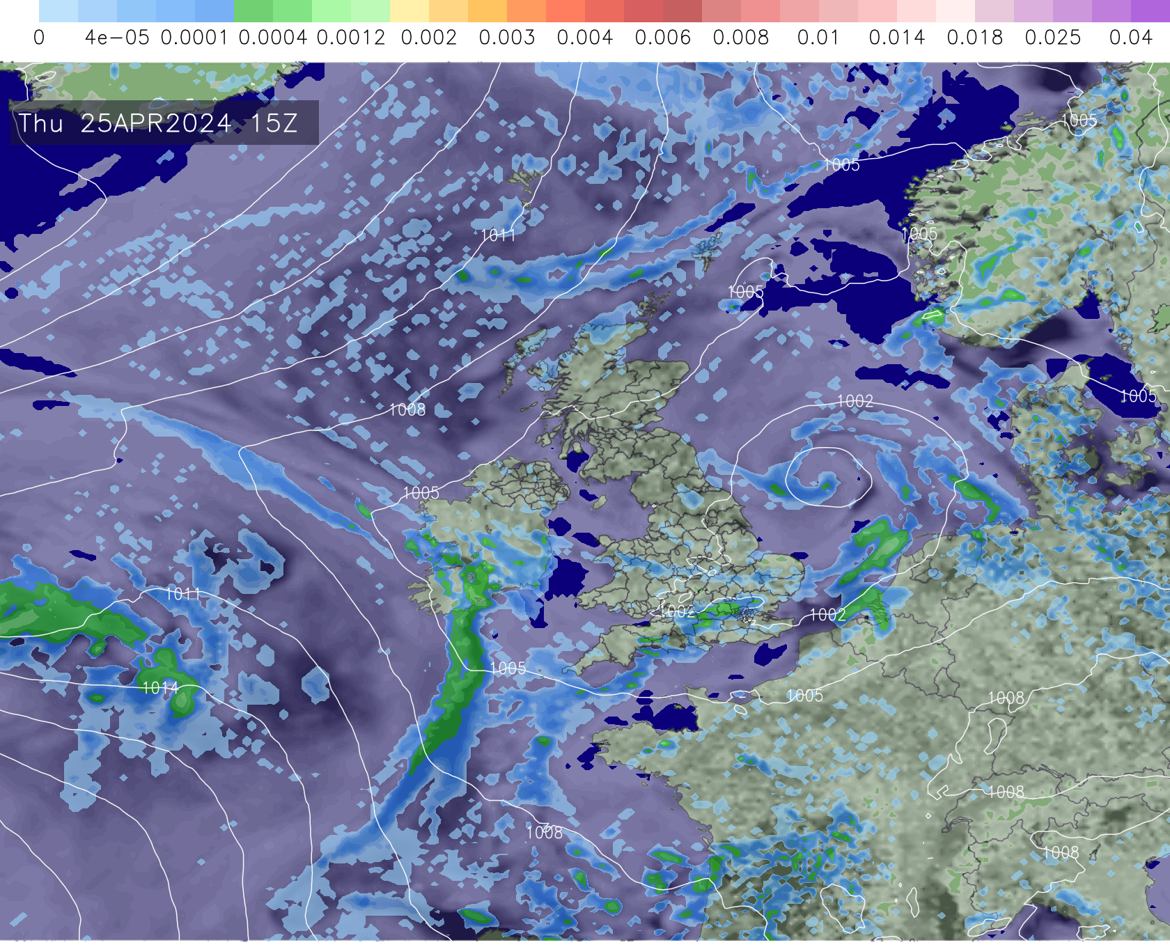
Today sees showers and longer spells of rain affecting northeastern and eastern parts of the country with wet weather also developing later in the day across southern and south-eastern areas.
As we head into tomorrow we’ll see yet further wet weather across parts of the south-west and south!
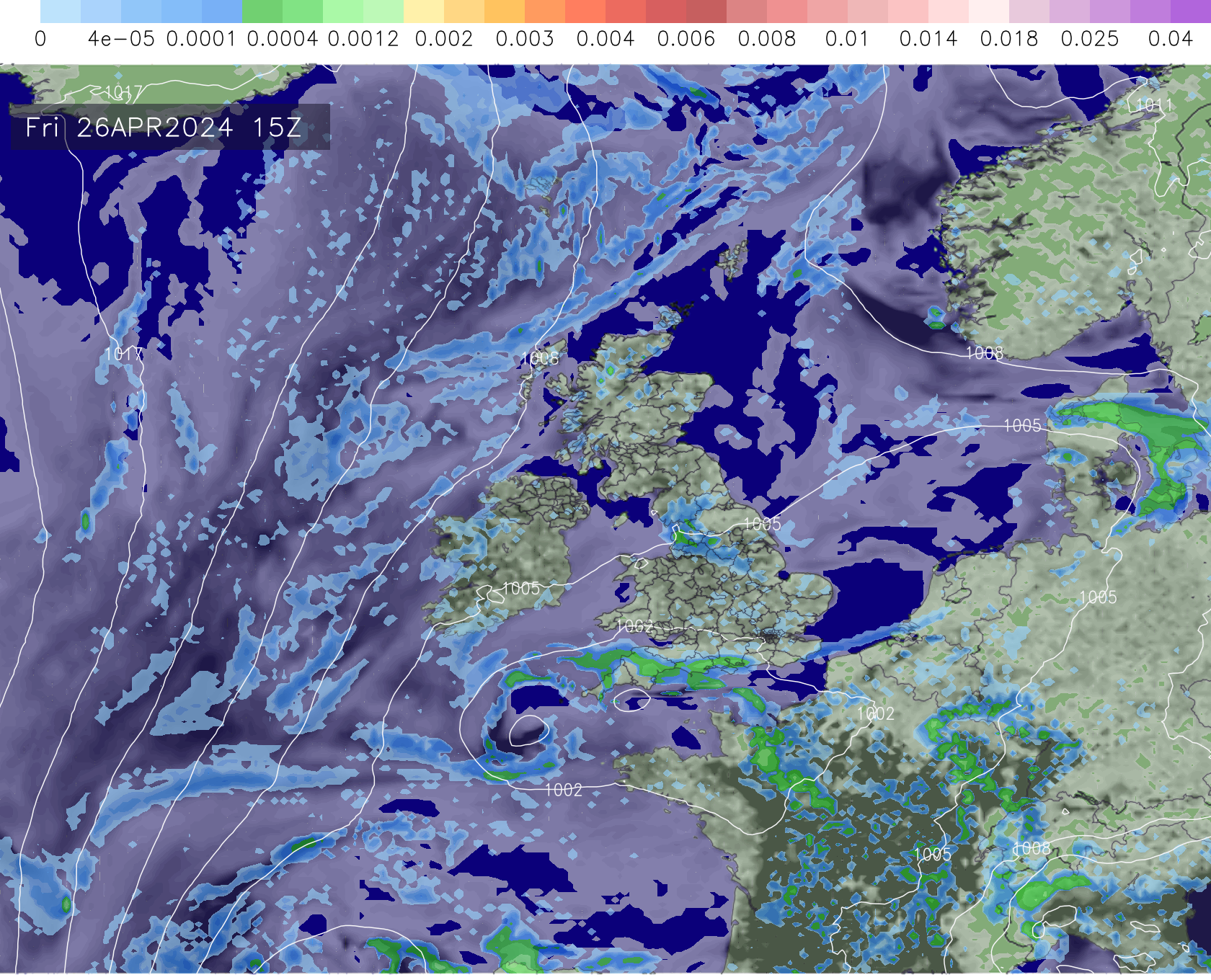
The wet weather tomorrow, initially affecting southern and southwestern parts of England, will eventually move into south-east England and continue to push north into more central parts of England through the day.
The frontal system will be slow moving on its journey north, so certainly a wet overnight period to come Friday night into Saturday as the front positions across central areas! The system will then move into Yorkshire and Lincolnshire through Saturday morning, eventually clearing through the day.
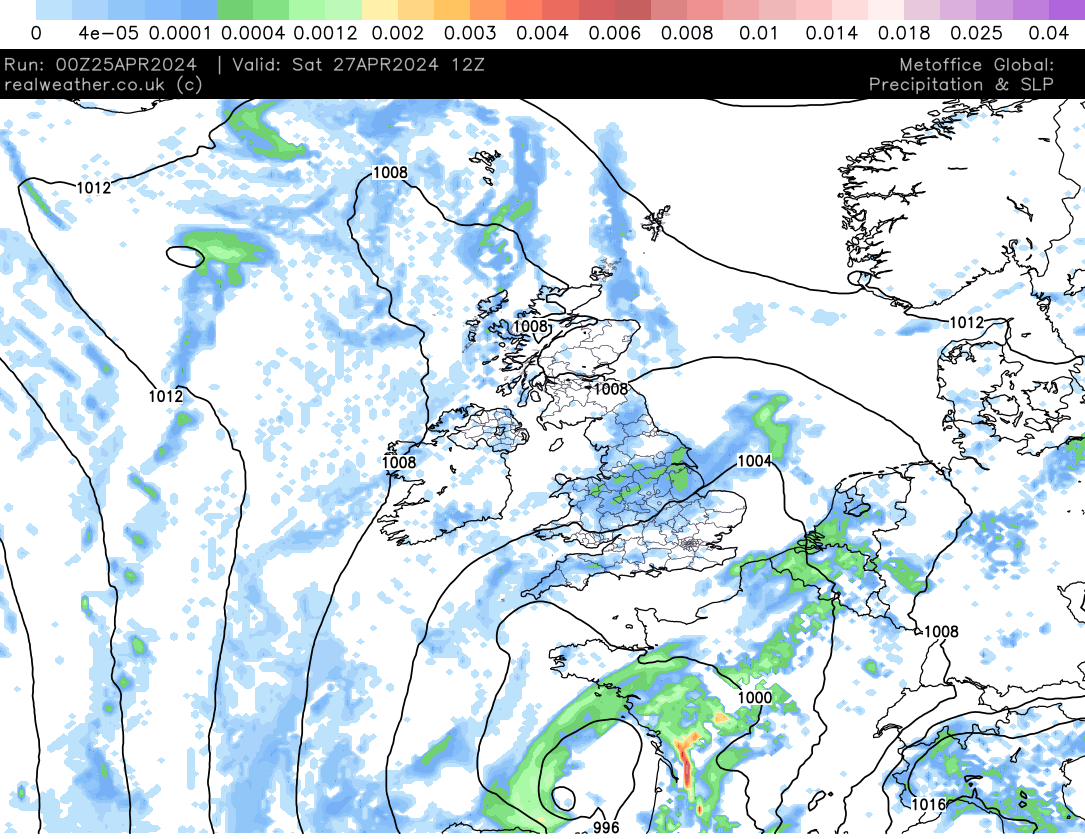
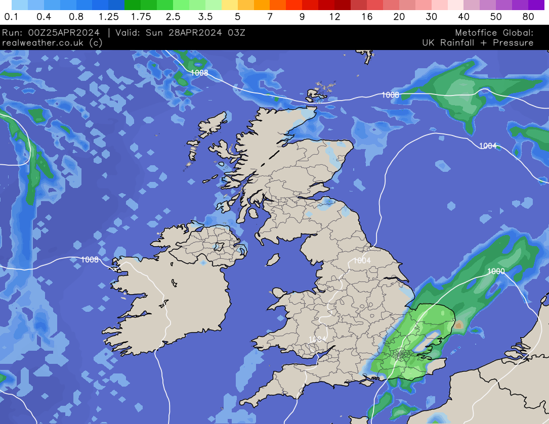
Conditions will improve in-behind this frontal system for much of England and Wales (away from northern areas). However, it won’t be long until the next system moves in across south-eastern and eastern areas overnight Saturday and into Sunday!
It is this system that is expected to bring some rather persistent and at times heavy rain.
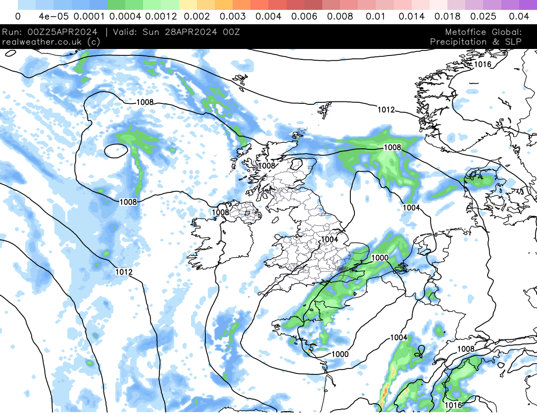
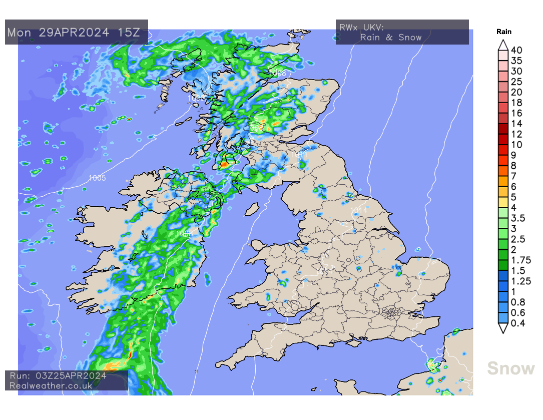
Northern areas, for example; Northern Ireland and Scotland, will see sunshine and showers throughout the weekend period, avoiding the main bulk of persistent wet weather.
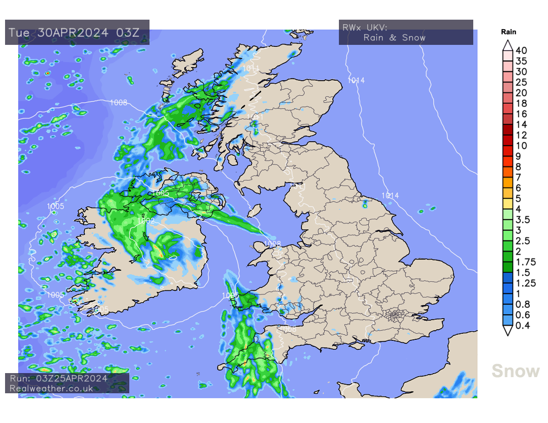
However, as we head into next week, whilst much of England and Wales will see the weather settling down on Monday and Tuesday, it will be western and northwestern parts of the United Kingdom that sees wet weather with fronts moving in from the Atlantic.
Looking further ahead and midweek of next week is likely to see further areas of rainfall affecting eastern, southern and southeastern parts of England, perhaps heavy and thundery at times.
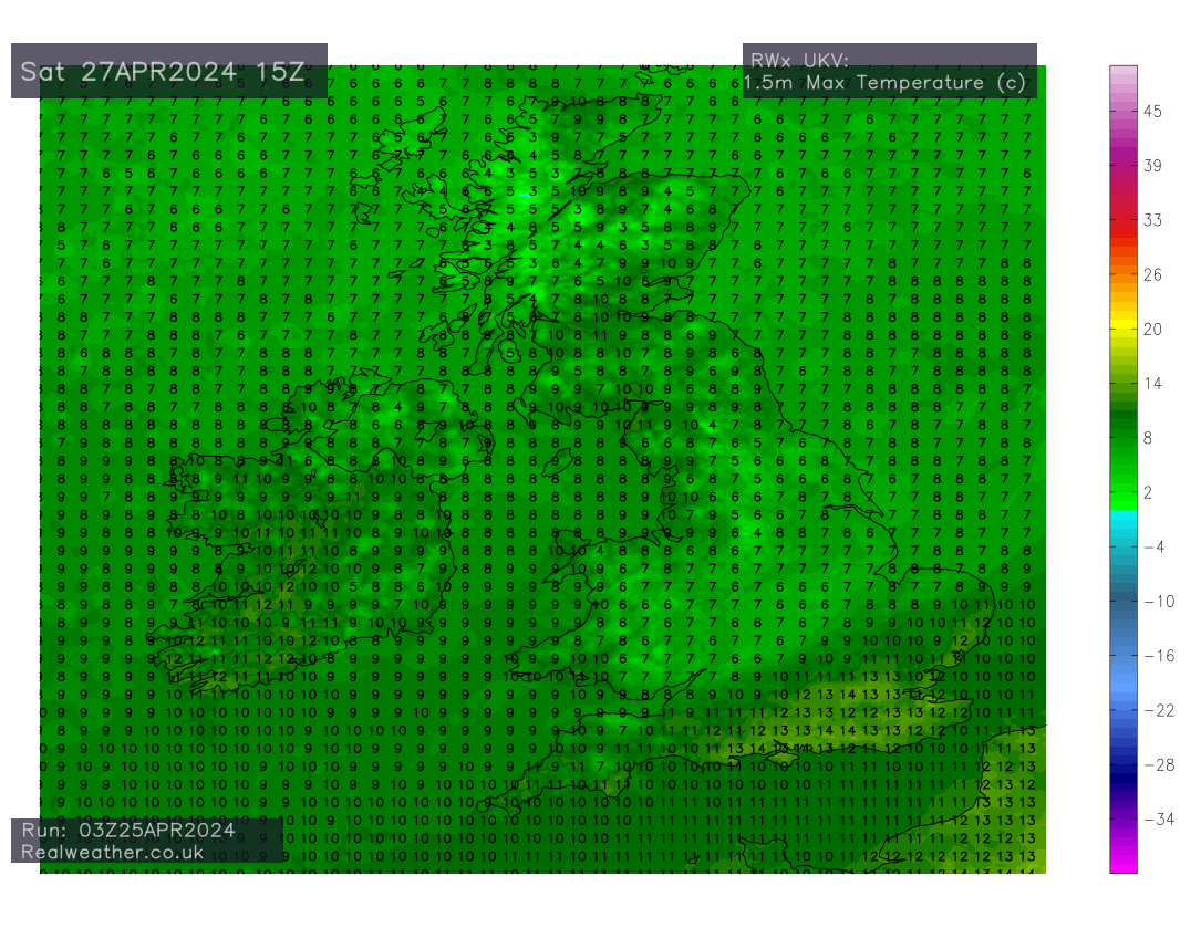
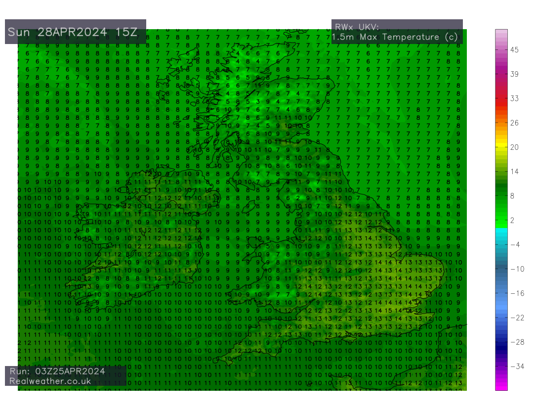
Temperatures will struggle this weekend, especially for areas under persistent rainfall and we will maintain a frost risk over the coming nights, especially in the north but not exclusively. Please find Saturday’s and Sunday’s maximum temperatures below.
Video animation below showing rainfall and pressure for the next 5 days