What a difference a week makes! Of late we’ve basked in glorious sunshine and warm temperatures with very little, if no rainfall in sight. I’m afraid that is set to change this week as we see low pressure take hold of our weather. I say I’m afraid, but I know for many, especially those of you with allotments and landscaping jobs or hobbies have been crying out for some rainfall as the ground is very dry and hard at the moment.
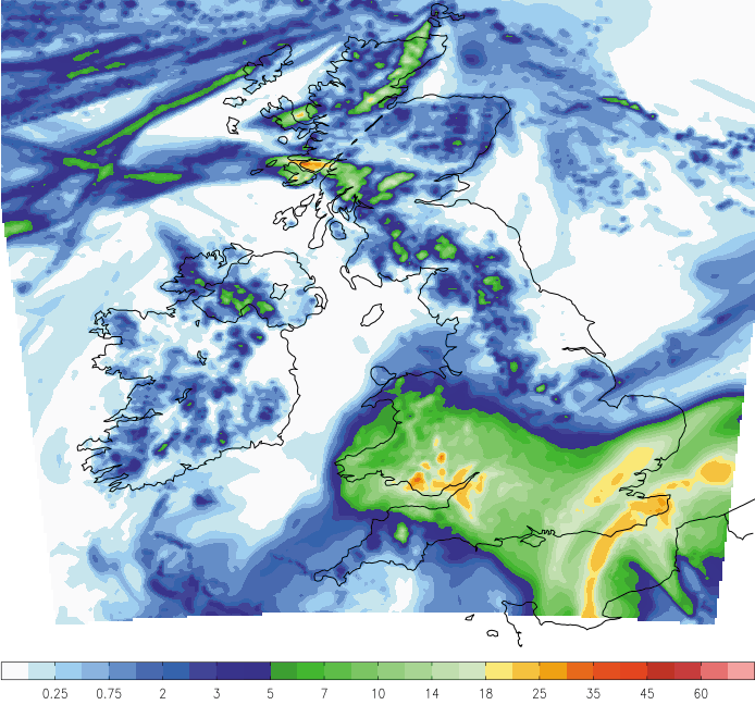
Initially the wettest weather or majority of any rainfall will be across the southern half of the United Kingdom during the next 24-30 hours with Wales, southern and southeastern parts of England seeing the main bulk of rainfall accumulations based on our highly accurate short range weather models. Below you’ll find a graphic from our 3km weather model which shows how much rainfall is expected to fall in mm during the next 32 hours or so.
Later today we see some patchy rainfall developing across parts of the southwest (Cornwall, Devon and Dorset for example) this will then become heavier and more persistent as it tracks northwards into Wales this evening/tonight. The main area will then develop and exit France tonight and into the early hours of tomorrow morning and will extend further northwards and northeastwards bringing some rather wet weather to parts of the south and southeast tomorrow morning.
As can be seen on the above graphic the main rainfall totals during the next 30 hours or so will be across south Wales and around the Bristol Channel, Essex and southern most parts of East Anglia and also Southeast England, especially Kent. Generally speaking rainfall totals will be around 12-15mm across the southern half of the United Kingdom (south of the Midlands) with 20-25mm locally in the southeast.
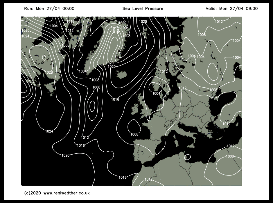
But what about the rest of the United Kingdom, when will we see some rainfall? As we progress through the week we’ll see areas of low pressure develop and these will start to track further north bringing wet weather across more northern areas. As highlighted on the animation below, low pressure dominates our weather this week.
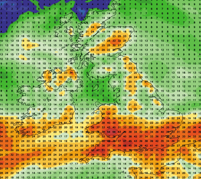
As a result of low pressure systems tracking further north we’ll see larger rainfall totals extend northwards across the rest of the United Kingdom. Please find total expected rainfall (in mm) from now until Sunday evening for the UK. The southern half of the United Kingdom certainly sees the main bulk of the rain! Lewis