
The weather across the UK for the past several weeks has been incredibly dry and with no meaningful rain to come in the forecast next week and possibly beyond, we will hit drought levels with bans being imposed before summer officially starts. Is the stratosphere to blame?
The question will be for many, why has this dry spell occurred? Well in this article I will try and answer that with in depth data and re-analysis. Cast your minds back to early March, where we had a big warming in stratosphere above the Polar region. This eventually caused a sudden stratospheric warming.
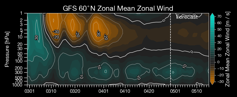
What caused this warming event? Well after looking through various sets of data, the likely cause was the Madden-Julian Oscillation (MJO). The MJO is enhanced tropical convection across the equatorial regions of the globe. This tropical activity when is certain strong phases, generates large atmospheric waves called Rossby waves, these propagate poleward and upward into the stratosphere and will have been the major driver to cause this sudden warming in the stratosphere, which as shown below actually reversed the winds across the Polar region.
So now we know the cause off the SSW, now let’s looks at the effects.
What an SSW Does:
- A Sudden Stratospheric Warming disrupts the polar vortex, often leading to a reversal of the usual west-to-east winds high up in the stratosphere.
- This disruption can propagate downward into the troposphere (where our weather happens), often over the course of 2–4 weeks.
- The result is often a blocked pattern with high pressure over the mid-latitudes, including the UK.
Early March SSW:
- As there was a notable SSW in early March 2025, it has led to a more blocked and sluggish jet stream in the weeks that followed.
- This kind of setup tends to increase the odds of northern Europe and the UK experiencing dry, settled conditions, especially if the high pressure locks in, which it clearly has.
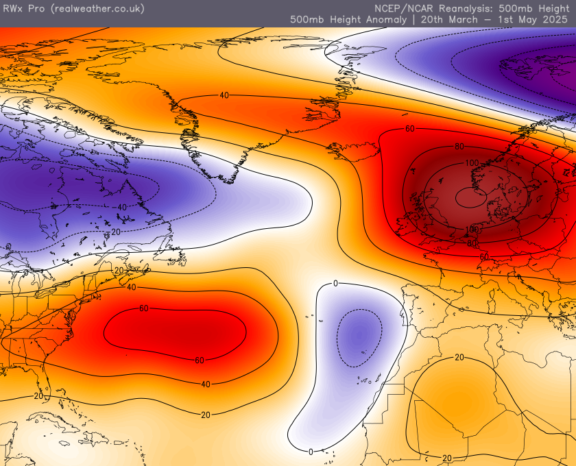
Furthermore other variables which could spoil or remove the high such as the MJO becoming strong in an unfavourable phase or even the ENSO region (La Nina/El Nino) becoming a driver of the weather, just isn’t there. Both of these teleconections have been largely quiet, effectively allowing the high to stay locked in. The data below from the 20th of March to the 1st of May shows the persistent heights across the UK or very close to the UK, either way completely blocking the Atlantic off and forcing lower heights much further south than would normally be the case and will be the major cause of the flash flooding across the Canary Islands recently.
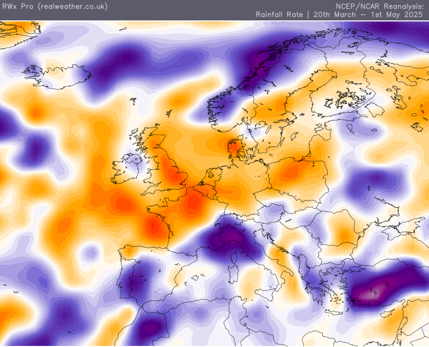
So there we have it, yes it is unusual to see such a persistent high pressure across our shores given we are tiny island, with often such variation in the weather, and this is very well highlighted as well by the data below. Here we have rainfall data from the same period (March 20th to May 1st) and while a lot of the UK has been very dry, its not the case across parts of Ireland, in particular Northern Ireland.

I hope this article gives you a good insight as to what drives our weather and how these drivers can all influence our weather but also fight against each other as well, which often brings us forecasters large headaches!!!