

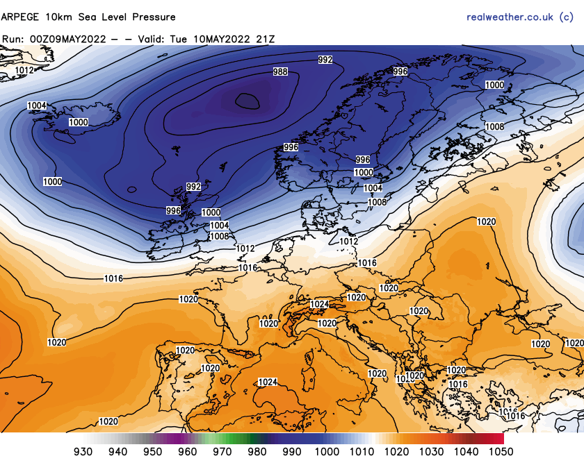
Lower pressure will be the theme during the working week with showers and at times longer spells of rain, mainly across the north and west. Despite lower pressure being the theme, I’m afraid many central, eastern, southern and south-eastern areas will see little in the way of rainfall.
As we head towards Thursday and Friday, pressure will start to rise across the southern half of the United Kingdom and by the weekend period high pressure will establish across the United Kingdom.
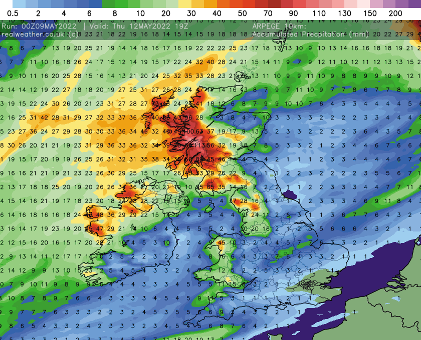
The weather of late has been rather dry with little in the way of rainfall, during April and to start May across much of England and Wales. This week will be no different, as can be seen on the below image that highlights how much rainfall is expected to fall in mm from now until Thursday, before pressure starts to build from the south again.
This weekend high pressure develops across the United Kingdom and some of the weather models are hinting at some much warmer air moving up from the near continent to affect the United Kingdom to start next week.
At the moment it does look as though central, southern, eastern and south-eastern areas will see the warmest temperatures for at least a couple of days, highs perhaps maxing out at 27c based on the current model outputs in the south-east of England.
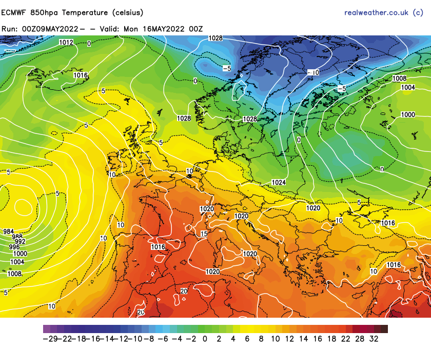
Where we go from there is the big question mark, some models, after low pressure briefly moves in from the west, perhaps bringing a thundery breakdown in the east, then brings a reload from the south with further warmer air under a slack flow bringing a rise in temperatures again, some outputs suggest high pressure developing bringing warm weather across the United Kingdom, even Scotland. Though there is a lot of uncertainty with regards to this at the moment. Lets take a quick look at some synoptic and temperature charts to highlight this.
Whilst many southern areas would see some much warmer temperatures, if the flow (wind) is from the ESE or SE this would bring slightly cooler temperatures to north sea facing coasts, however, inland areas would see some very warm, potentially locally hot temperatures developing.
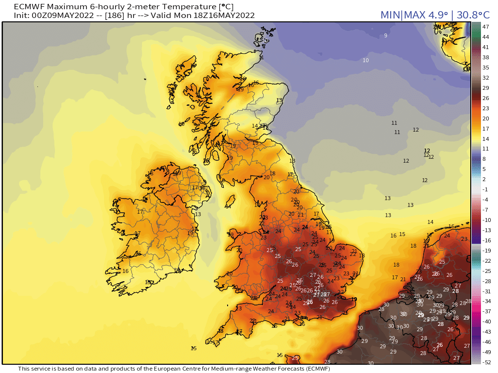
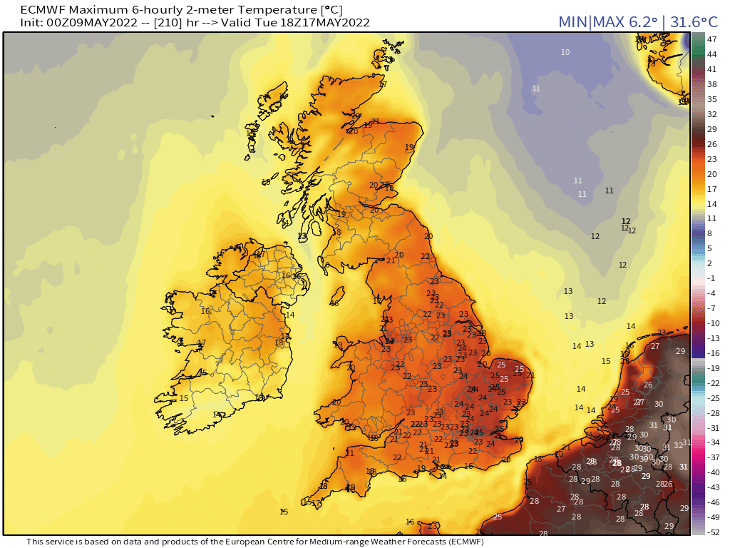
Northern and northwestern areas would remain milder than of late but with the threat of Atlantic systems moving in. Below are some maximum temperature charts for Monday 16th, Tuesday 17th and Wednesday 18th of May (next week).
Monday 16th May
Tuesday 17th May
Wednesday 18th May
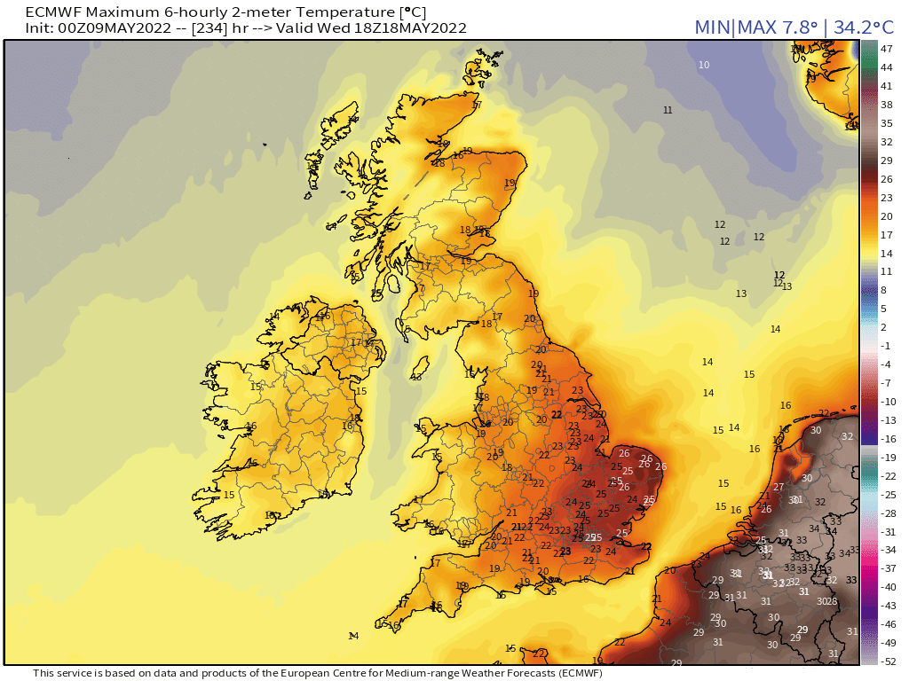
As can be seen on the above temperature charts, a warm up for a few days is certainly possible and the most likely scenario at the moment. How warm and how prolonged remains to be seen at the moment but the models will firm up on the outlook during the next couple of days.
There could even be a risk of some thunderstorms thrown into the mix if we do see a plume setup develop.
Whilst low pressure is the theme this working week, eastern, southern and southeastern areas will still remain on the milder side of day time maximums widely ranging from 17-19c.
As always I’ll keep you updated via Facebook and this website. If you wish to get the best forecasts in the United Kingdom then sign up to our pro service by clicking here.
Forecaster: Lewis