Always Personal – Personalised Gifts and Photo Gift
Real Weather are delighted to announce our new sponsor, Always Personal, part of the ukprint.group, a business local to Real Weather! They…

Public & Commercial weather services
Real Weather are delighted to announce our new sponsor, Always Personal, part of the ukprint.group, a business local to Real Weather! They…
× Our new Android APP! Get our new Pro Android APP FREE as part of Pro membership below! Here at Real Weather…
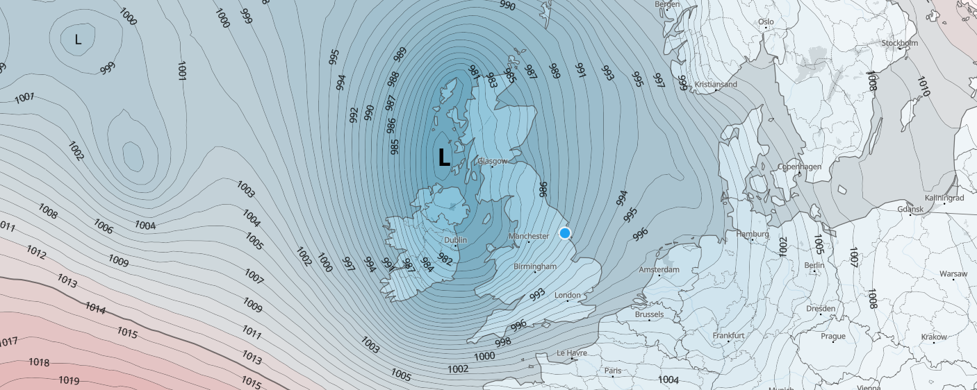
Low pressure will dominate our weather throughout the working week, bringing disruption to some parts of the United Kingdom on Tuesday and…

We’ve seen some rather contrasting Easter weekends over the last few years with heavy snow and bitterly cold temperatures or complete washouts.…
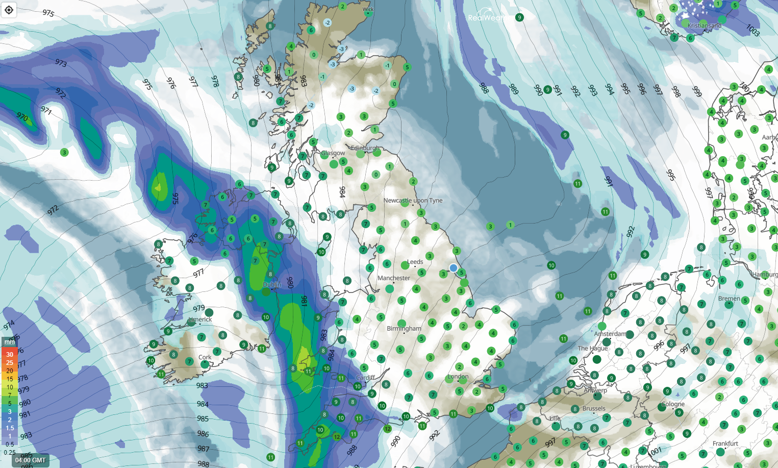
SUMMARY Wet weather moving in from the south-west this morning with strengthening winds across Cornwall, Devon, Somerset and also Irish sea coasts…
We’ve certainly experienced some very mild weather so far this Autumn with temperatures well above the seasonal average at times. Most recently…

SUMMARY Warmer from the south during the next couple of days. Showers in the north and northwest. Drier in the south and…

SYNOPTIC SUMMARY Higher pressure across the southern half of the United Kingdom. Slightly lower in the north with showers continuing for Scotland.…
SYNOPTIC SUMMARY Low pressure remains in charge across the United Kingdom, however, higher pressure developing from the south, especially later today and…
SYNOPTIC SUMMARY Low pressure still in charge with frontal systems moving west to east across the United Kingdom this morning. The rain…
Get access to all of our website features plus our new app via a paid account today. Radar, Live Lightning strikes, Thunderstorm and forecast features, Agri/farming weather, absolutely packed with content! Upgrade today!!