
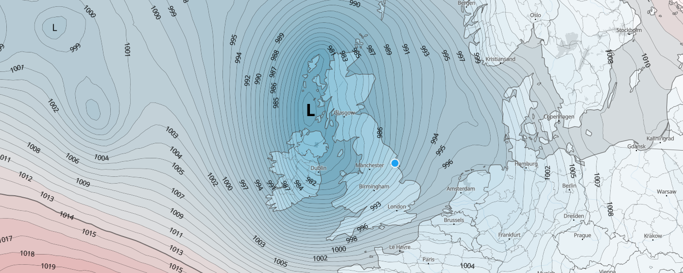
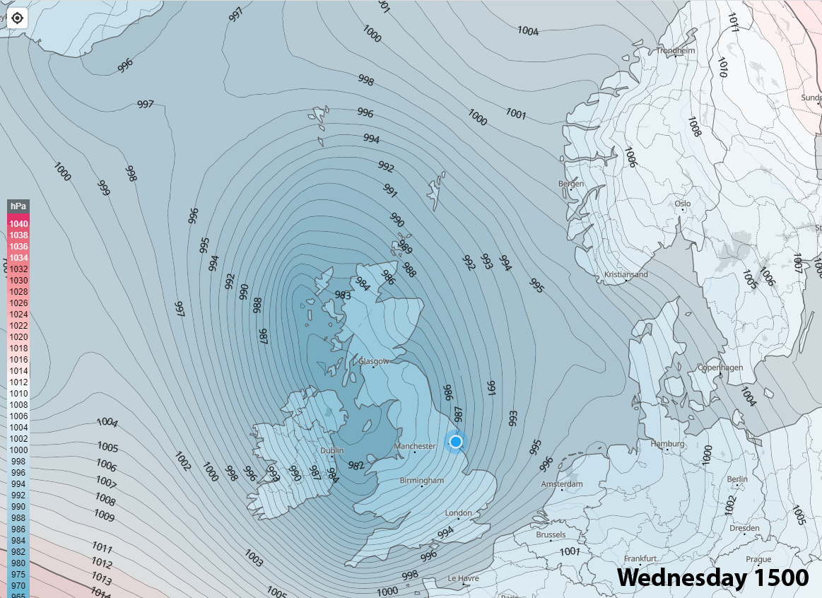
Low pressure will dominate our weather throughout the working week, bringing disruption to some parts of the United Kingdom on Tuesday and Wednesday, especially in the west, south-west and north-western parts of the United Kingdom.
The image below, from our interactive Pro models, that can be accessed via subscription on our website, highlights why we’re seeing these low pressure systems rapidly develop as they head towards the United Kingdom.
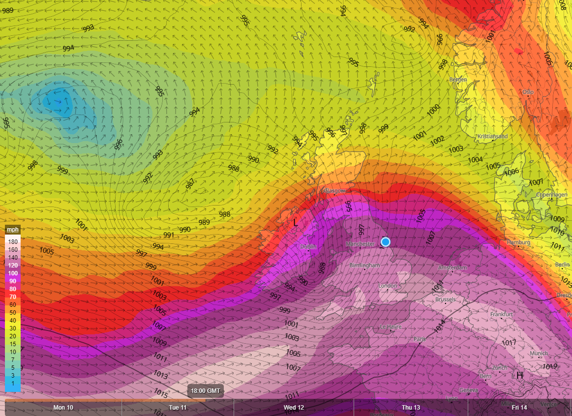
As can be clearly seen on the image above, a rather strong Jet stream is aligned across the United Kingdom, running off the Atlantic. Typically, during this time of the year, we see a weaker Jet stream with the jet tracking further north of the United Kingdom.
At the moment we’re seeing a southerly tracking Jet stream and the Jet stream is basically acting as a conveyor belt for these areas of low pressure that develop out in the Atlantic.
They catch a ride on the Jet stream and head into the United Kingdom and if any particular low pressure system catches the jet at the right time, we can see some rather deep and potent lows develop. That is exactly what will happen during the next 48 hours or so.
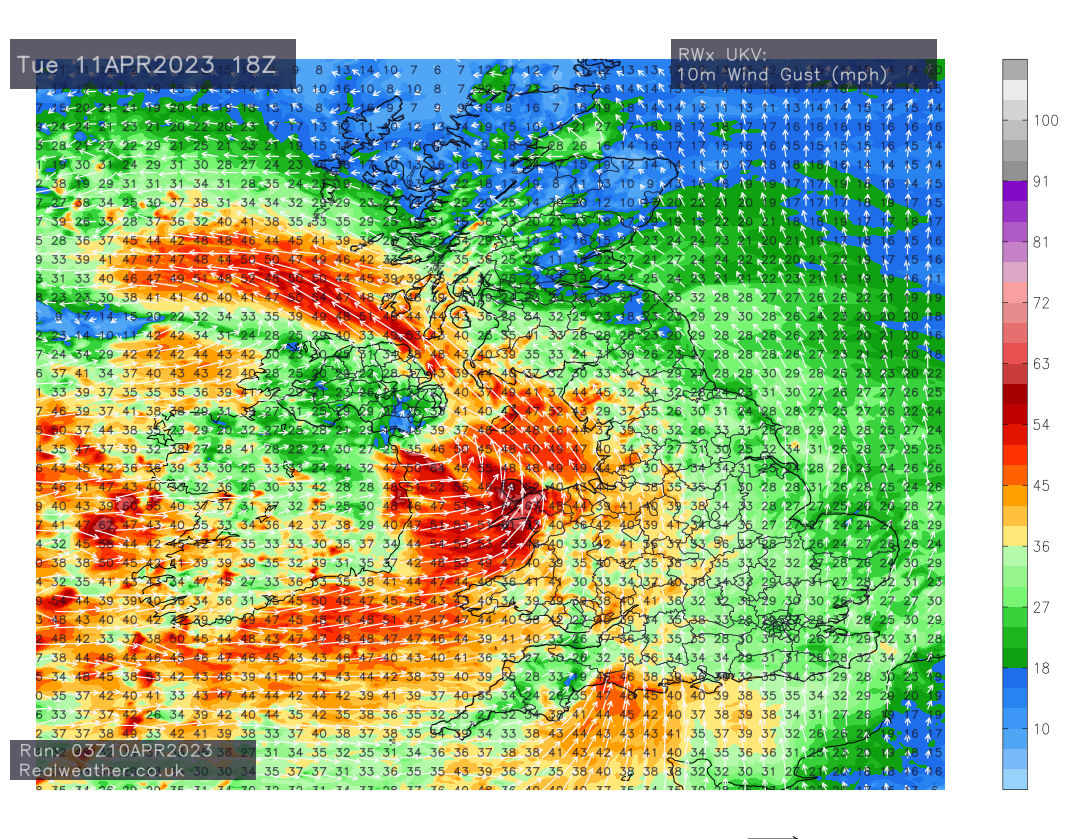
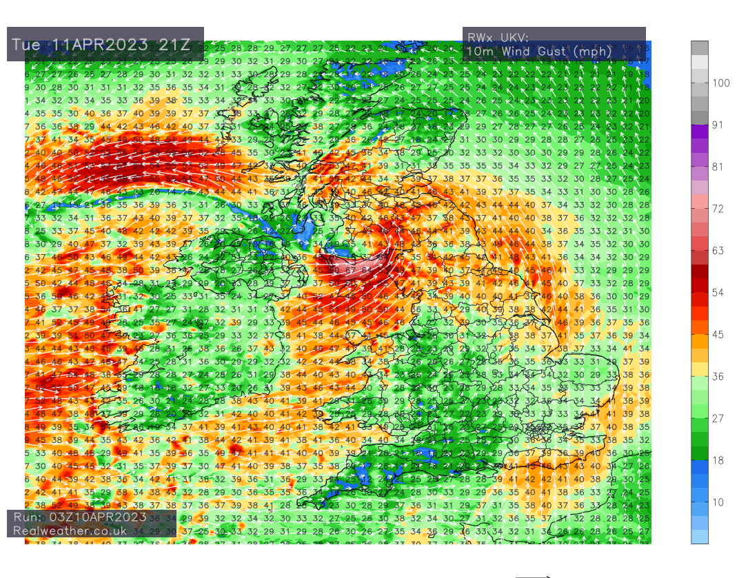
We will initially see strong winds develop across Ireland, Irish sea coasts of Wales, south-west England and W/SW Scotland throughout Tuesday with gusts typically around 50-60mph along exposed coasts.
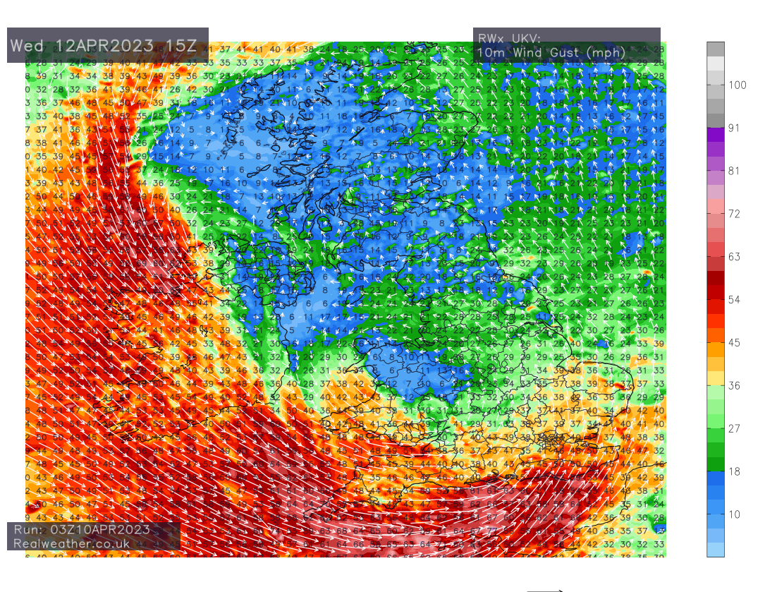
Locally we may see in excess of 65mph for a time, most likely later on Tuesday across the Isle of man and extreme coastal parts of south-west Scotland. As can be seen on the charts below from our UKV charts.
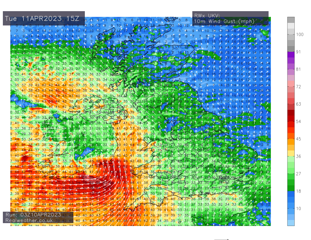
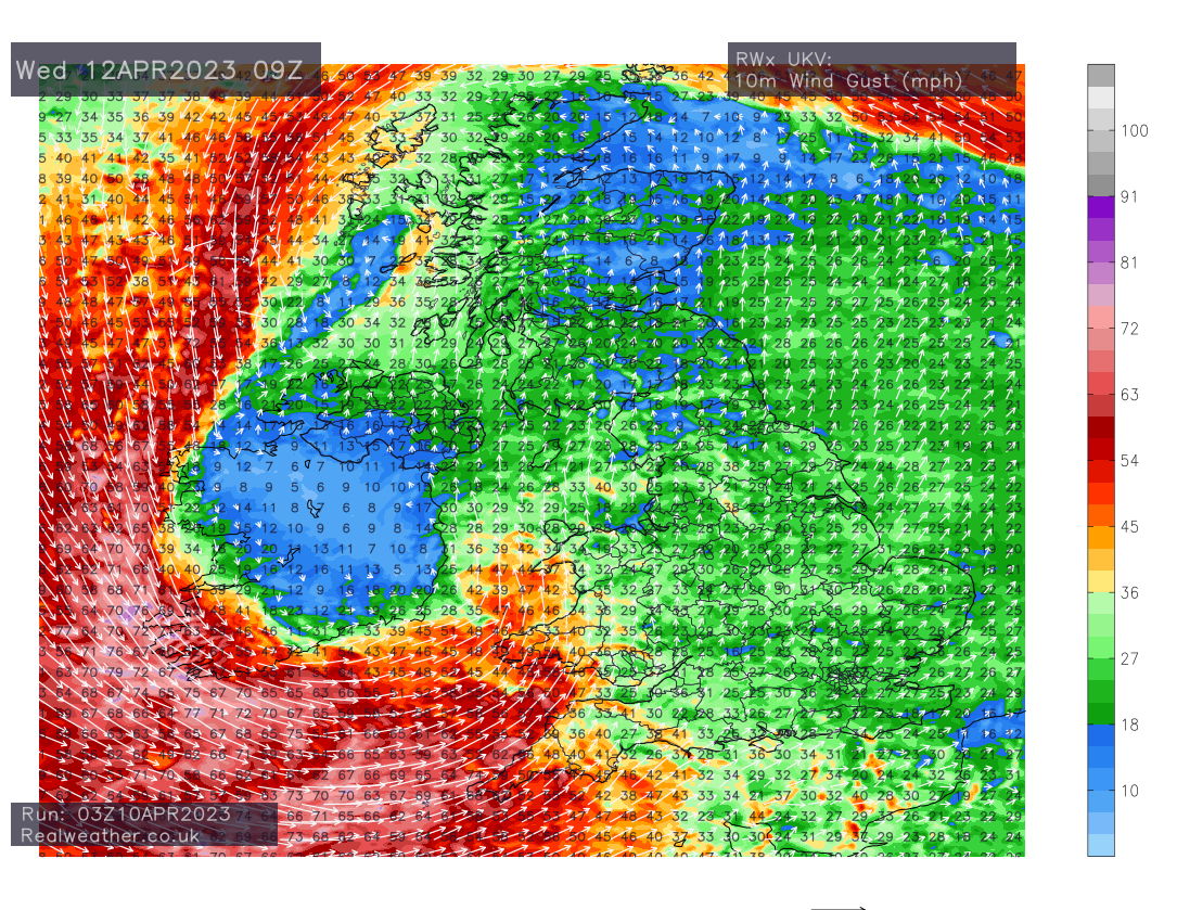
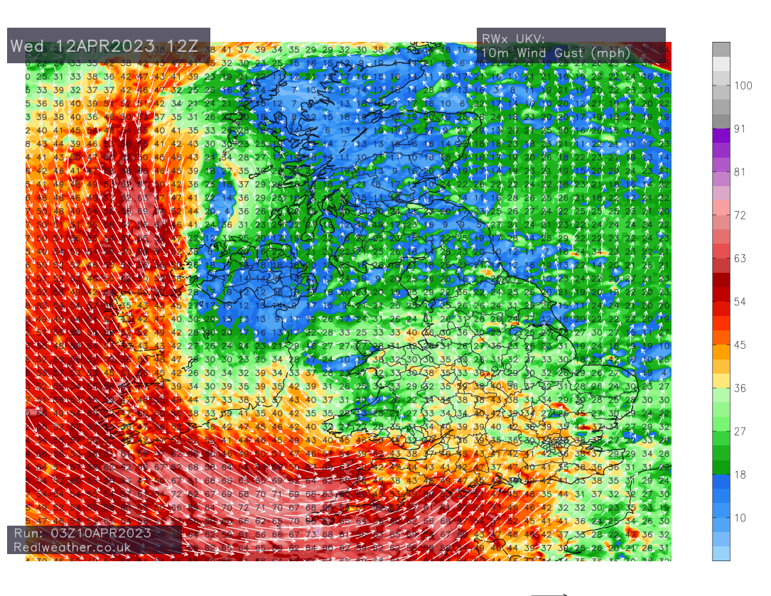
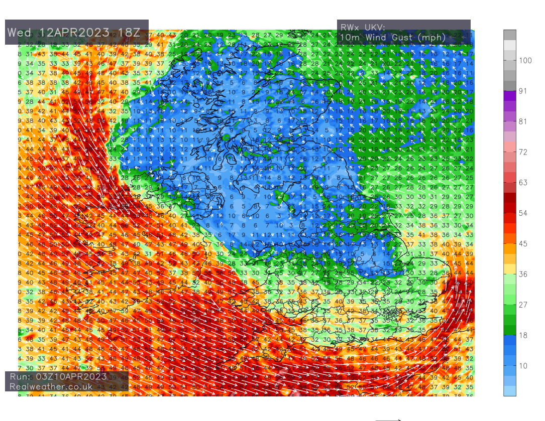
The main focus on the strongest winds will be into Wednesday morning as we see some very strong winds developing on the southern flank of the system for a time. Gusts in excess of 60mph are showing across some parts of the south-west and along Channel coasts.
The UKV model even shows gusts in excess of 75mph for parts of Ireland on Wednesday morning! We will initially see the strong winds affecting the south-west and Irish sea coasts Wednesday morning with the strong winds then transferring eastwards along S England and Channel coasts in general.
So certainly, going by latest model data available, a rather unsettled and potentially disruptive spell of weather is on the way Tuesday and more especially into Wednesday for western and some southern parts of the United Kingdom.
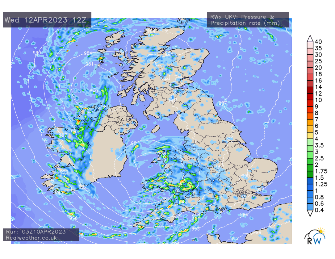
Whilst strong winds will be the main focus, we’ll also see rainfall accompanying the windy weather. Frontal systems in from the west on Tuesday and into Wednesday with heavy showers, thundery at times packing in across much of England and Wales throughout Wednesday. Northern Ireland and Scotland also seeing their fair share of weather weather!
We may even see showers fall of sleet and snow over the highest ground in the north for a time as the low pressure system has some colder upper air embedded within.
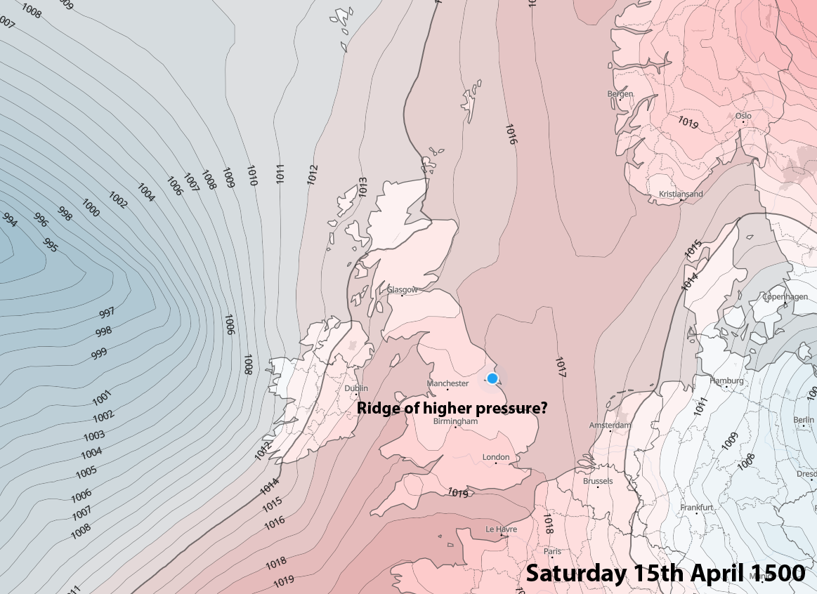
Everything but the kitchen sink to come this week with perhaps high pressure establishing later in the week, perhaps just in time for the weekend, settling the weather down and bringing some milder temperatures! We have an unsettled working week of weather to come first though! I’ll have more on the weekends prospects tomorrow.
As always, I’ll keep you updated via our Free Facebook page and more extensively via our private Facebook group. Click here if you wish to upgrade to our private service.