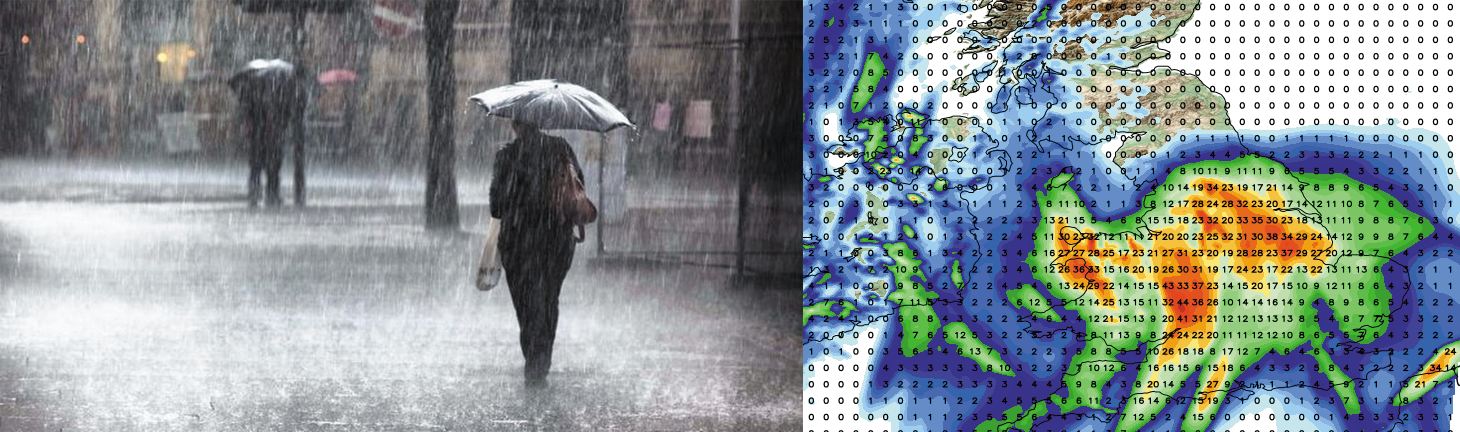
Heavy and at times thundery rain pushing northeastwards tomorrow
A spell of wet weather is expected across many central and eastern parts of England tomorrow with parts of the East Midlands,…

Public & Commercial weather services
A spell of wet weather is expected across many central and eastern parts of England tomorrow with parts of the East Midlands,…
Good afternoon and welcome to this weeks mid-week weather update looking ahead at the weather for the remainder of the week in…

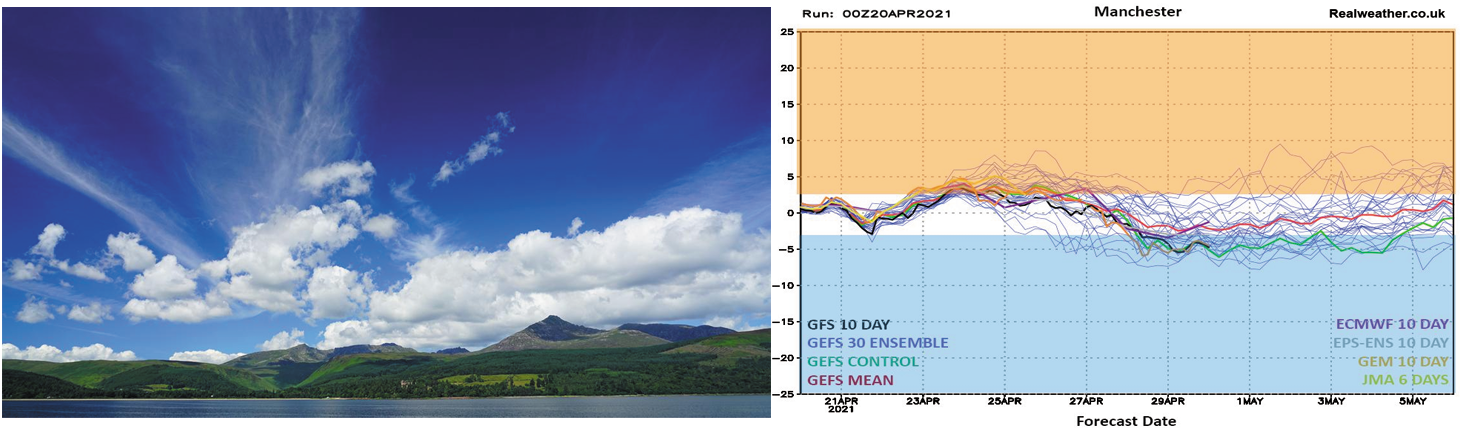
High pressure is set to continue across the United Kingdom this week. We do have the small matter of cloud and rain…
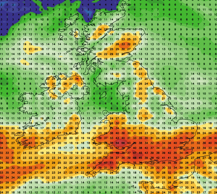
What a difference a week makes! Of late we’ve basked in glorious sunshine and warm temperatures with very little, if no rainfall…
The United Kingdom has certainly experienced a very wet Autumn and winter so far and I’m afraid the wet and generally milder…
Good evening guys. Please find a quick video below just highlighting the potential for some snowfall this week. I know some people…
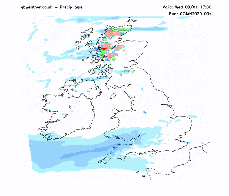
Northern and western areas start the day on a very wet and windy note with the far east and southeast fairing best,…
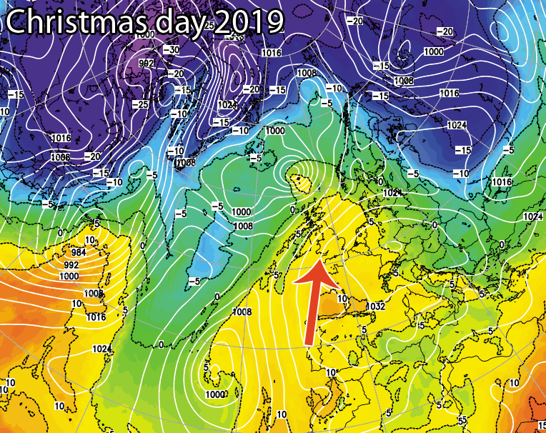
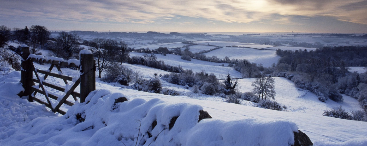
The countdown is on to the big day and each day we’ll give an update on the chances of a white Christmas…
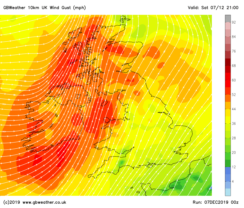
A deep area of low pressure will move in from the west on Sunday and into Monday bringing very strong winds across…
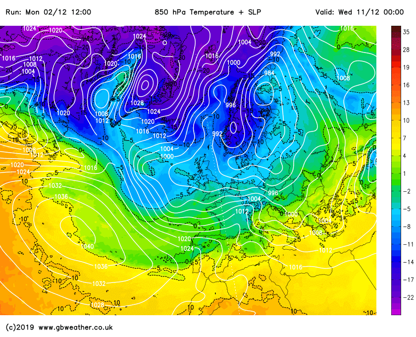
For the last 10 days or so we’ve been mentioning the risk of much colder weather developing around the 10th of December.…
Get access to all of our website features plus our new app via a paid account today. Radar, Live Lightning strikes, Thunderstorm and forecast features, Agri/farming weather, absolutely packed with content! Upgrade today!!