
The latest model outputs continue to show much colder air being sourced all the way from Siberia moving into the United Kingdom this weekend. Initially the weather models had the colder air in the form of an easterly affecting the United Kingdom this Sunday into Monday of next week. The models have now brought the said event forward with the very cold air now expected to hit the United Kingdom this Saturday! Below is a chart from our GFS weather model.

Whilst there still remains some uncertainty with regards to how potent the easterly blast will be and how much snow will fall, what I can tell you is that based on the latest model output snow will be in the forecast, with the potential for some disruptive falls of snow across eastern, northeastern and perhaps southeastern parts of England and Scotland.
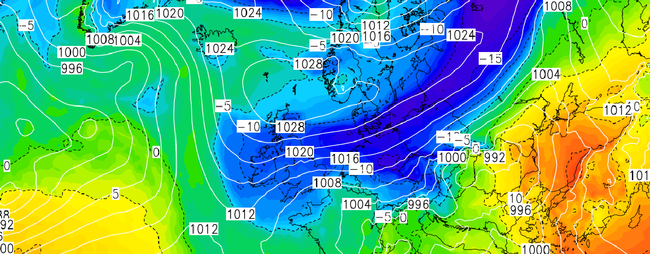
The ECMWF model like the GFS model goes with the similar theme of very cold air moving in on Saturday, as shown on the image below.

The GFS weather model is showing some very cold daytime and overnight minimums with daytime temperatures struggling to get above freezing on Saturday and Sunday, especially across northern, eastern and central areas.

Overnight minimum will widely reach -2 to -4c overnight Saturday into Sunday with perhaps lows locally dropping to -7c/-8c, especially where there is any snow cover.

The expected cold spell of weather is expected to last into next week with cold air in place under high pressure which will lead to cold daytime temperatures and low overnight minimums throughout next week.
The initial easterly blast is expected to last 2-3 days based on current model outputs. So to conclude it is turning colder, still exacts to be firmed up within the forecast, however snow is looking increasingly likely across northern, eastern and southeastern parts of the United Kingdom with showers perhaps moving inland to affect other areas at times.
We’ll keep you updated as always.
Chief Forecaster Lewis Dobson