
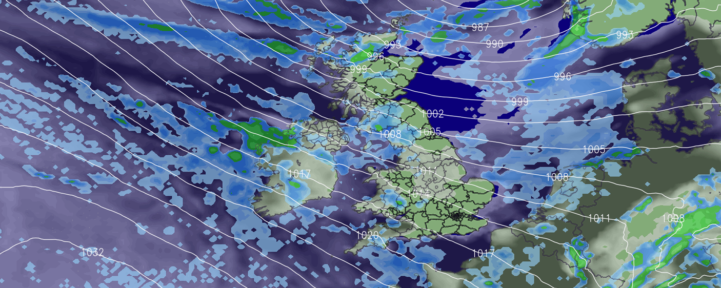
We are almost at April and so far the start of Spring has been rather unsettled indeed! Plenty of rain has brought flooding issues in places and heavily saturated ground, it really isn’t the best start, not just in general but especially for those in the agricultural sector!
At the moment we are stuck in a rut synoptically and by now you are probably wondering if and when the weather will improve.
I’m afraid there are no signals pointing at drier, settled and generally milder weather at the moment. The reason for this is due to the strength and positioning of the jetstream. You can see the jet stream on the image below, dated for tomorrow (Friday 22nd March) positioned across the UK.
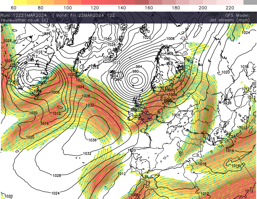
You may see a little ridge of high pressure to the west of the United Kingdom, but don’t get excited as the jet rides over the top and we see low pressure from the northwest influencing our weather this weekend.
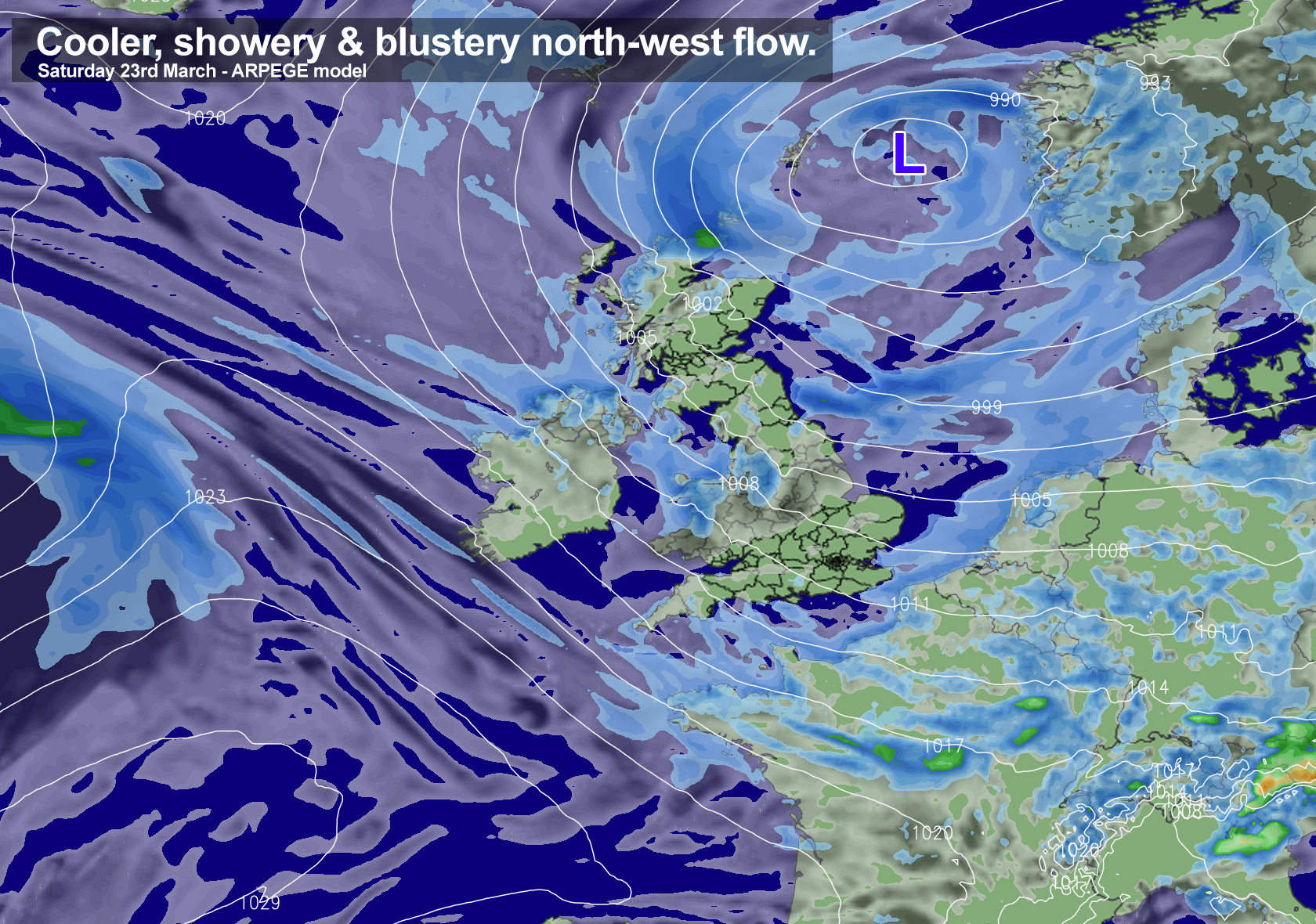
This weekend certainly won’t be a wash out for all of us, it will be more of a sunshine and showery regime with cooler temperatures than of late. Cold enough for something wintry to the highest ground in the north with snow accumulations over the mountains of Scotland!
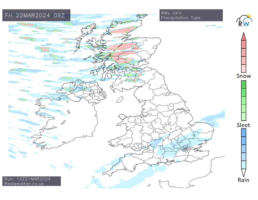
You may even notice some sleet and hail mixed in during the heaviest of showers, especially if you’re in the north.
Friday precipitation type
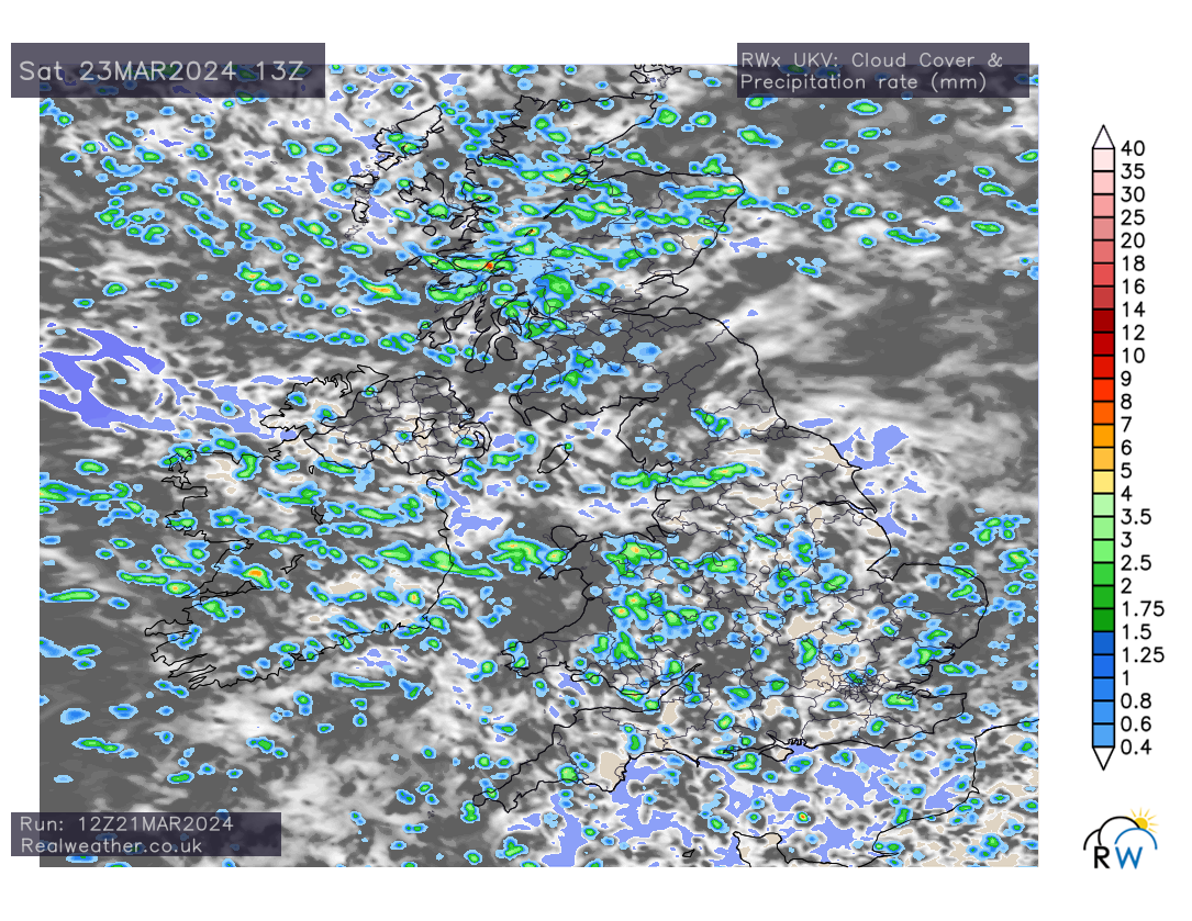
It will be northern, northwestern and western areas that experience the main bulk of showers on Friday through to Sunday, however, especially on Saturday, England and Wales see an enhanced shower risk.
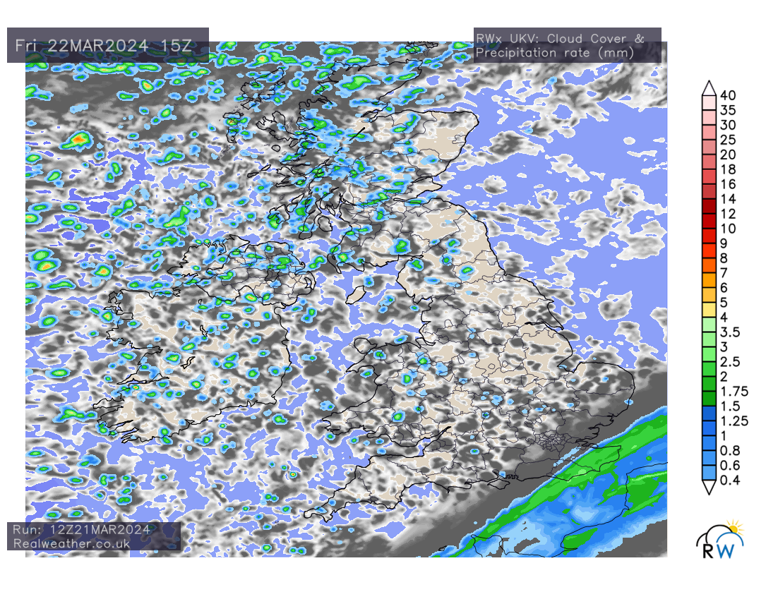
Friday precipitation (rain) rate with cloud cover
Saturday precipitation (rain) rate with cloud cover
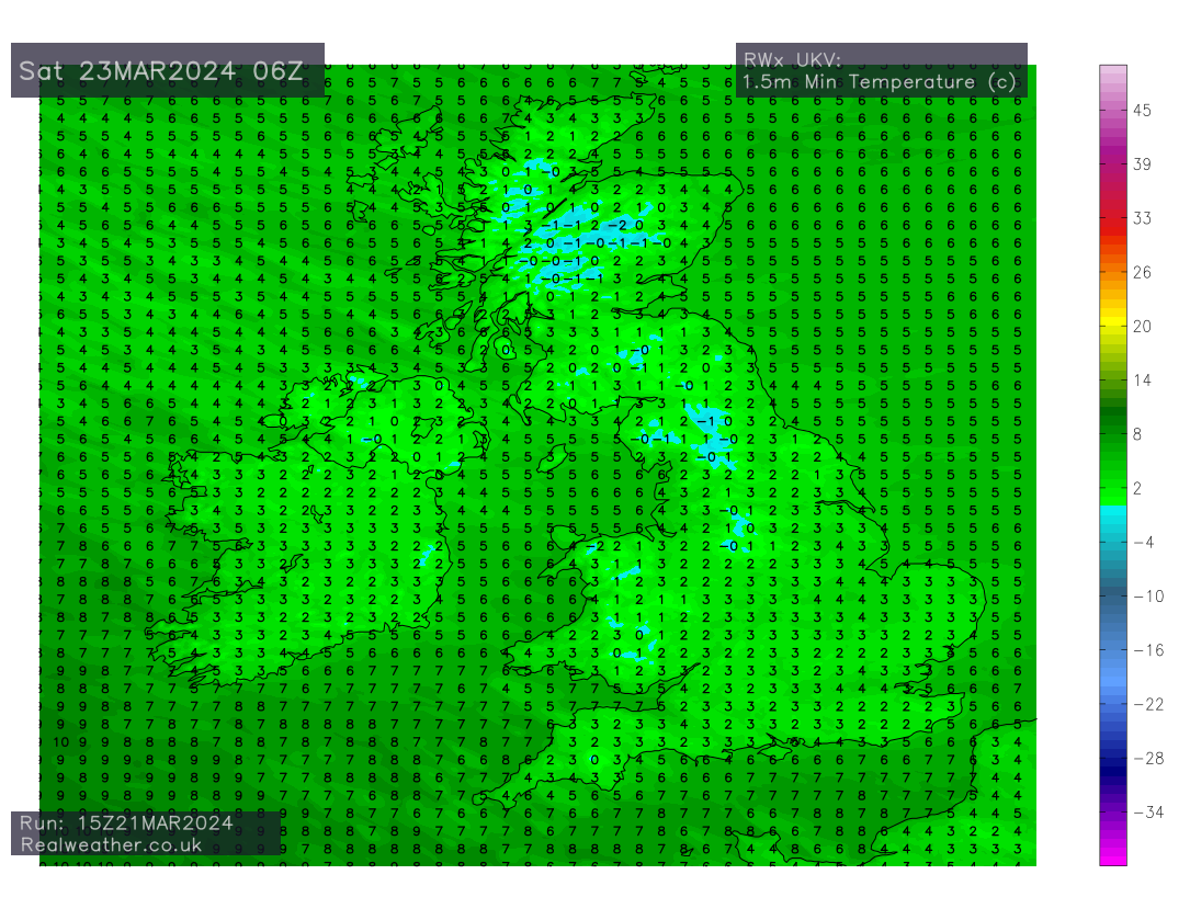
It will certainly feel fresher than of late with temperatures, especially during the overnight period taking a dip and dropping low enough, for not only a ground frost but also an air frost locally in the north and perhaps sheltered inland western areas.
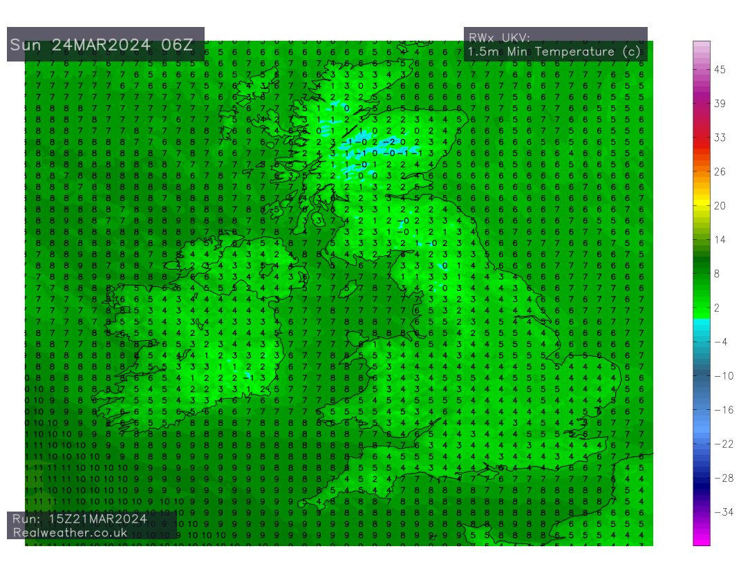
Lets take a quick look at the overnight minimums for the weekend period.
Saturday 6AM – Minimum temperatures
Sunday 6AM – Minimum temperatures
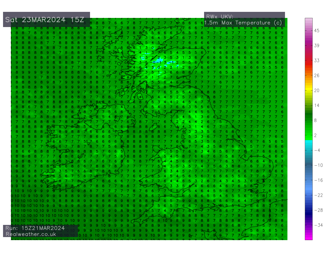
Saturday day time maximums
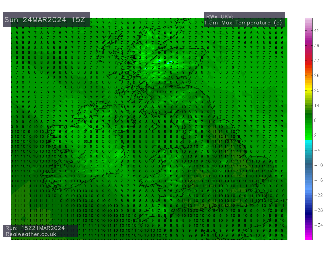
Sunday day time maximums
Sunday overall should be an improving picture for most and temperatures will be a little higher across England and Wales, despite a shower risk continuing in places. Though later on Sunday, we see the next system move in from the Atlantic.
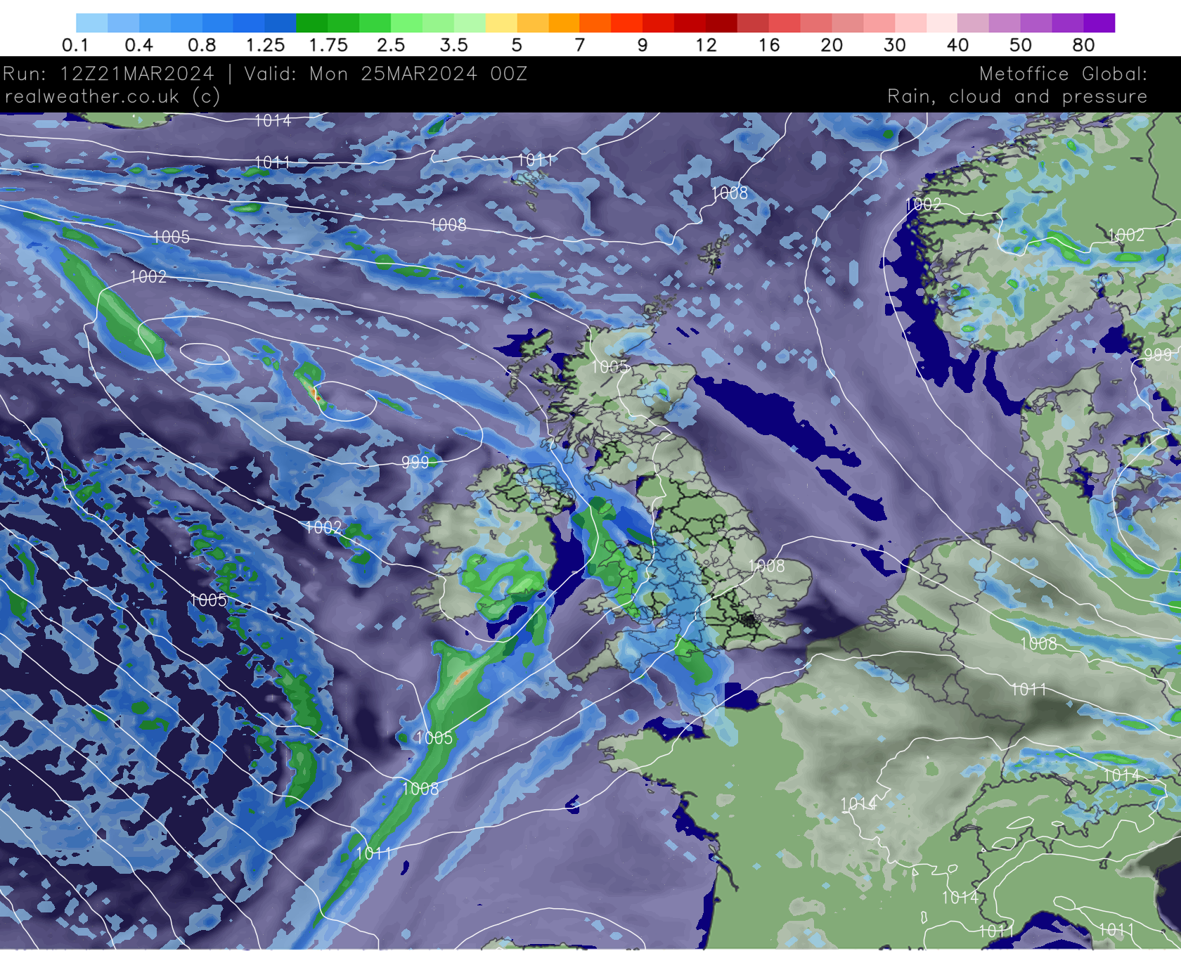
This then sets the theme for what will be an unsettled week, with low pressure dominating!
I have created a quick video animation from the latest ECMWF model run below, which clearly shows the unsettled theme, with low pressure dominating throughout next week and potentially into the following week!
One positive to take from the latest ECM model is that in 10 day’s time the rain my be warmer!