


Much needed rain for many this week as low pressure dominates
What a difference a week makes! Of late we’ve basked in glorious sunshine and warm temperatures with very little, if no rainfall in sight. I’m afraid that is set to change this week as we see low pressure take hold of our weather. I say I’m afraid, but I know for many, especially those of you with allotments and landscaping jobs or hobbies have been crying out for some rainfall as the ground is very dry and hard at the moment. Initially the wettest weather or majority of any rainfall will be across the southern half of the United Kingdom during the next 24-30 hours with Wales, southern and southeastern parts of England seeing the main bulk of rainfall …
Read More »
Omnipotent Jet Stream but where is the snow?
The United Kingdom has certainly experienced a very wet Autumn and winter so far and I’m afraid the wet and generally milder conditions are set to continue, at least throughout most of January. The reason for the unsettled weather is the position and strength of the Jet Stream. The jet stream is a fast flowing current of air higher up in the atmosphere, in fact the jet stream is located near the tropopause with prevailing westerly winds. The strength and position of the Jet Stream is very important to the UK’s weather as it controls our weather patterns, direction of these patterns and at times also the strength of low pressure systems, for example if a rapidly developing area of low …
Read More »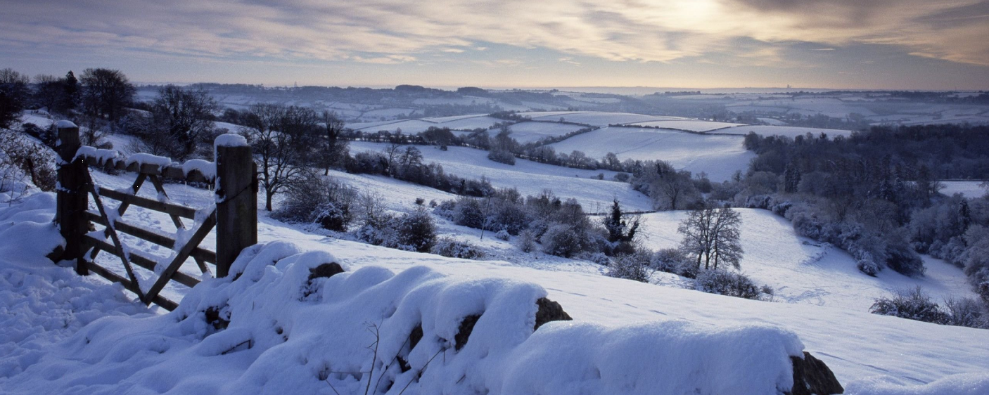
Snow update video – highlighting this weeks potential
Good evening guys. Please find a quick video below just highlighting the potential for some snowfall this week. I know some people can get confused but I just thought this would maybe give you more of an insight with regards to what is going on.. As I mentioned on the video these are the type of videos and even more extensive videos you get inside the premium group everyday. If you want to signup then feel free to click the link, signup and then comment done and we’ll get you across to the pro group and set you up with your own pro username and password for the website features. Signup: https://www.paypal.com/cgi-bin/webscr?cmd=_s-xclick&hosted_button_id=N5P3N7KKLX7PA Thanks – Lewis
Read More »
A windy day in store with gales moving east!
Northern and western areas start the day on a very wet and windy note with the far east and southeast fairing best, at the moment, however it is downhill as we go through the day. Yet another area of low pressure is currently moving across the United Kingdom and it is introducing some very strong winds and further wet weather. The wet weather will transfer eastwards throughout the day as will the strong winds. We’ll see a secondary wave of heavy rain developing across northwestern areas later in the day. Irish sea coasts will see wind gusts in excess of 65mph, possibly 70mph for a time with inland gusts across much of England and Wales ranging from 50-60mph. The …
Read More »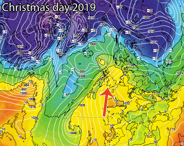
Christmas 2019 Weather updates – Will it be a white Christmas?
The countdown is on to the big day and each day we’ll give an update on the chances of a white Christmas and a rough idea of what weather to expect for the big day. You will find the updates below. Update #3 – 11th December Well well well.. The models are actually showing something much colder for the big day. Whilst I would take it with a pinch of salt at the moment, perhaps a small pinch for the time being, the ensembles from the models are showing colder scenarios for the big day, nothing set in stone yet but I’m sure you’ll enjoy the ups and downs of these daily updates. The latest chart from …
Read More »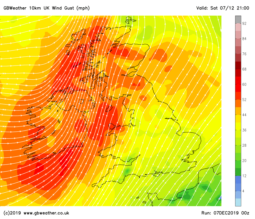
Storm Atiya moves in Sunday – Batten down the hatches
A deep area of low pressure will move in from the west on Sunday and into Monday bringing very strong winds across parts of Ireland, Wales, Irish sea coasts in general and southwestern parts of England. The strong winds will initially affect parts of Northern Ireland and Ireland before transferring into Wales, Northwestern parts of England and the southwest of England. Gusts inland across northwestern parts of England, Wales, W Midlands and SW England will range from 50-55mph widely, perhaps exceeding 60mph for a time. Across Irish sea coasts and exposed locations gusts in excess of 70mph are to be expected. Whilst there will be a wave of strong winds across these areas later today the main wave of strong …
Read More »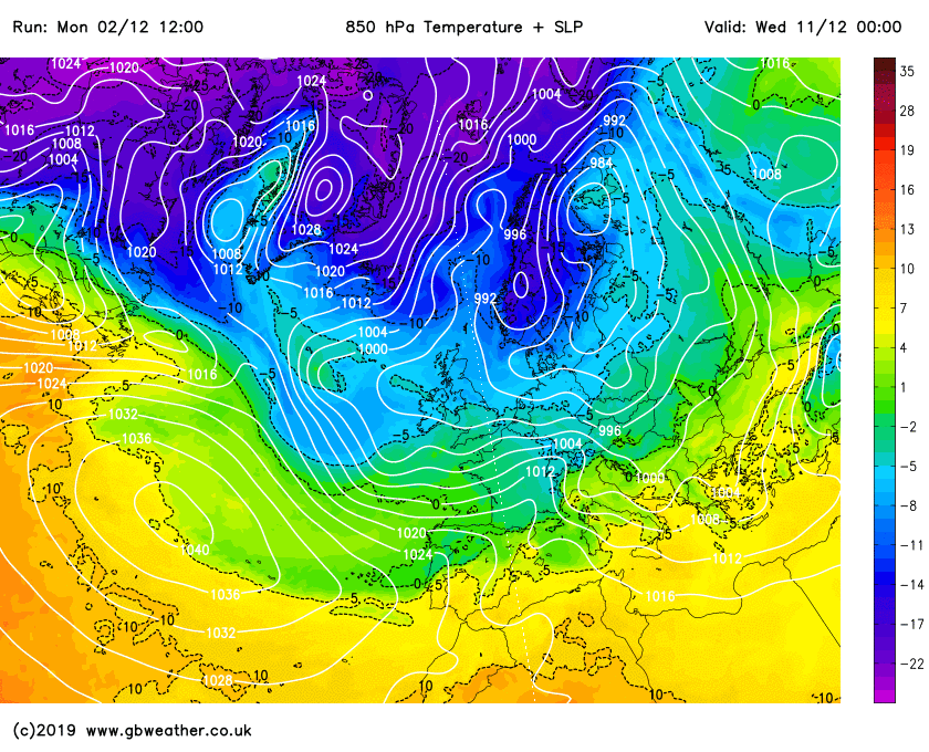
Is a cold blast with snow on the way? – The Latest
For the last 10 days or so we’ve been mentioning the risk of much colder weather developing around the 10th of December. The models have been toying with the idea, with some of the output showing very cold and snowy weather, yet other model outputs have showed milder Atlantic driven weather. The chopping and changing between the models have sent forecasters on a wild goose chase it would seem, however we’re now starting to see better agreement and support from various models which point towards some colder weather developing. Now we’re not talking about massive amounts of snow and bitterly cold temperatures at this range, at the moment we’re more than likely to see much colder weather developing with a …
Read More »
Winter thoughts – Beast from the East?
It is that time of the year again, woohoo (sorry I do love winter) where winter is nearly open us, OK yes there is the small matter of Autumn to get out of the way first but…. one thing I do want to say before we go into more detail is that I do expect a colder than average winter and I also expect more snow events compared to previous winters. I do however have to disagree with some of the headlines doing the rounds on Facebook at the moment, headlines such as ‘Coldest winter in 30 years’ and ‘The beast from the east is coming back’. My techniques at reading long range data and climatological data have proved pretty …
Read More »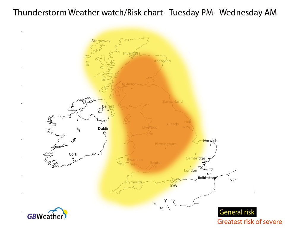
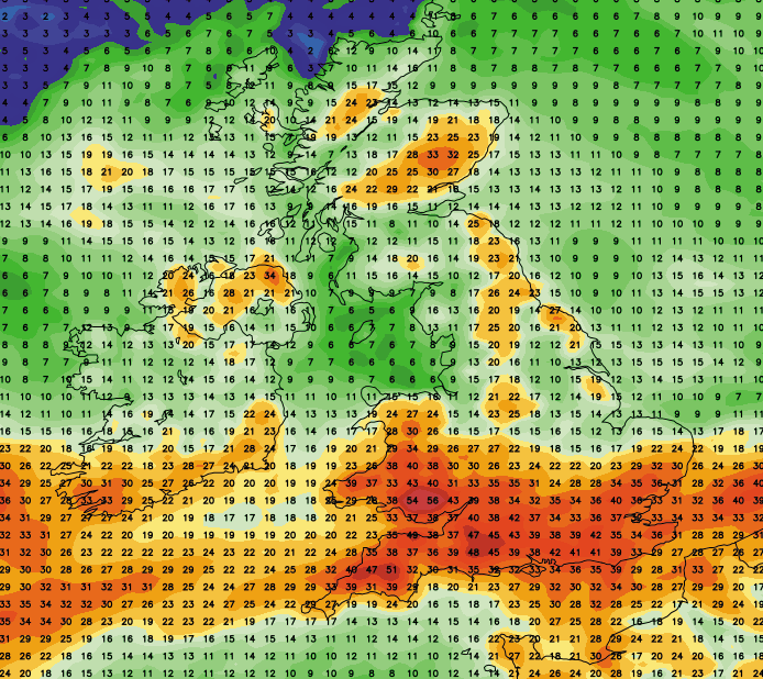
Severe thunderstorm risk – Warning Issued
There is a risk of severe thunderstorms affecting parts of Wales, central England, northern and northwestern parts of England, Yorkshire, Lincolnshire and Scotland late tonight and into the early hours of Wednesday morning. Whilst other areas (highlighted on the below map) are at risk of seeing some locally heavy thunderstorms the main emphasis is central and northern areas (marked in orange on the map). Areas of thunderstorms are expected to develop across parts of Wales and the W Midlands tonight and these will then track northeastwards late tonight and into the early hours of Wednesday morning. They’re expected to intensify as they track northeastwards. Frequent lightning, hail, gusty winds and heavy downpours are to be expected. The …
Read More »
Watch Live lightning in Eastbourne
Upgrade to premium today by clicking here – get the best forecasts in the UK. Feed by Webcamtaxi
Read More »